APER YF.APER - Earthquake Result Viewer
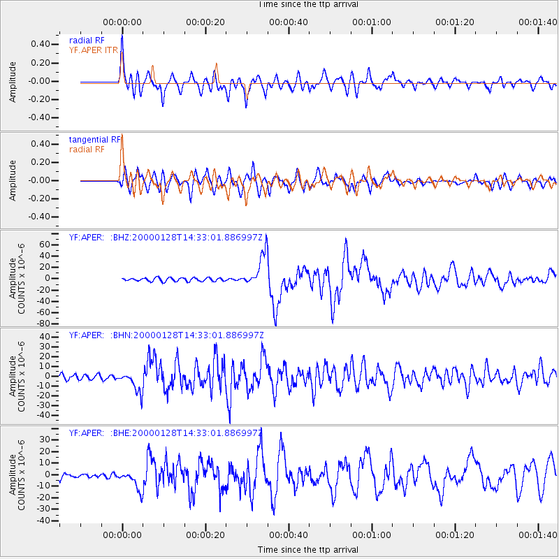
Earthquake location: Kuril Islands
Earthquake latitude/longitude: 43.0/146.8
Earthquake time(UTC): 2000/01/28 (028) 14:21:07 GMT
Earthquake Depth: 61 km
Earthquake Magnitude: 6.7 MB, 6.6 MS, 6.8 MW, 6.8 ME
Earthquake Catalog/Contributor: WHDF/NEIC
Network: YF Midsea - Mantle Investigation of the Deep Suture between Eurasia and Africa
Station: APER YF.APER
Lat/Lon: 35.55 N/27.17 E
Elevation: 250 m
Distance: 84.4 deg
Az: 314.602 deg
Baz: 39.799 deg
Ray Param: 0.04540582
Estimated Moho Depth: 61.0 km
Estimated Crust Vp/Vs: 2.10
Assumed Crust Vp: 5.627 km/s
Estimated Crust Vs: 2.683 km/s
Estimated Crust Poisson's Ratio: 0.35
Radial Match: 88.66356 %
Radial Bump: 400
Transverse Match: 87.966576 %
Transverse Bump: 400
SOD ConfigId: 3744
Insert Time: 2010-03-08 22:35:12.456 +0000
GWidth: 2.5
Max Bumps: 400
Tol: 0.001

Signal To Noise

ChannelStoNSTALTA
YF:APER: :BHN:20000128T14:33:01.886997Z4.08346271.0937202E-52.6784137E-6
YF:APER: :BHE:20000128T14:33:01.886997Z4.58505968.858372E-61.932008E-6
YF:APER: :BHZ:20000128T14:33:01.886997Z10.431833.0728857E-52.9456821E-6
Arrivals
Ps12 SECOND
PpPs33 SECOND
PsPs/PpSs45 SECOND