DUOK YF.DUOK - Earthquake Result Viewer
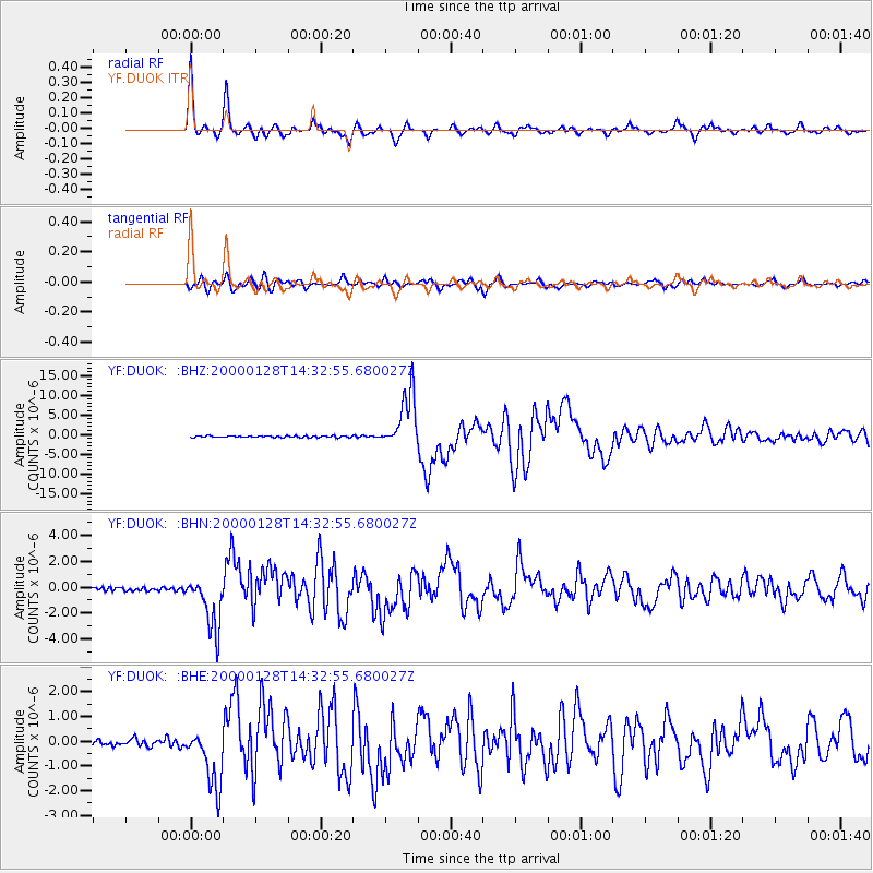
Earthquake location: Kuril Islands
Earthquake latitude/longitude: 43.0/146.8
Earthquake time(UTC): 2000/01/28 (028) 14:21:07 GMT
Earthquake Depth: 61 km
Earthquake Magnitude: 6.7 MB, 6.6 MS, 6.8 MW, 6.8 ME
Earthquake Catalog/Contributor: WHDF/NEIC
Network: YF Midsea - Mantle Investigation of the Deep Suture between Eurasia and Africa
Station: DUOK YF.DUOK
Lat/Lon: 44.11 N/14.93 E
Elevation: 115 m
Distance: 83.2 deg
Az: 327.321 deg
Baz: 33.334 deg
Ray Param: 0.0462701
Estimated Moho Depth: 44.25 km
Estimated Crust Vp/Vs: 1.76
Assumed Crust Vp: 6.291 km/s
Estimated Crust Vs: 3.564 km/s
Estimated Crust Poisson's Ratio: 0.26
Radial Match: 97.87305 %
Radial Bump: 395
Transverse Match: 93.19584 %
Transverse Bump: 400
SOD ConfigId: 16820
Insert Time: 2010-03-08 22:36:31.115 +0000
GWidth: 2.5
Max Bumps: 400
Tol: 0.001

Signal To Noise

ChannelStoNSTALTA
YF:DUOK: :BHN:20000128T14:32:55.680027Z15.1562712.0908858E-61.3795517E-7
YF:DUOK: :BHE:20000128T14:32:55.680027Z7.7747021.209475E-61.5556546E-7
YF:DUOK: :BHZ:20000128T14:32:55.680027Z34.374036.9798907E-62.0305708E-7
Arrivals
Ps5.5 SECOND
PpPs19 SECOND
PsPs/PpSs24 SECOND