DUOK YF.DUOK - Earthquake Result Viewer
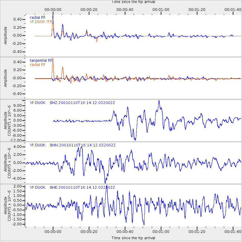
Earthquake location: Kodiak Island Region, Alaska
Earthquake latitude/longitude: 57.1/-153.2
Earthquake time(UTC): 2001/01/10 (010) 16:02:44 GMT
Earthquake Depth: 33 km
Earthquake Magnitude: 6.2 MB, 6.8 MS, 7.1 MW, 6.8 ML
Earthquake Catalog/Contributor: WHDF/NEIC
Network: YF Midsea - Mantle Investigation of the Deep Suture between Eurasia and Africa
Station: DUOK YF.DUOK
Lat/Lon: 44.11 N/14.93 E
Elevation: 115 m
Distance: 78.7 deg
Az: 8.681 deg
Baz: 353.429 deg
Ray Param: 0.049426988
Estimated Moho Depth: 43.75 km
Estimated Crust Vp/Vs: 1.77
Assumed Crust Vp: 6.291 km/s
Estimated Crust Vs: 3.554 km/s
Estimated Crust Poisson's Ratio: 0.27
Radial Match: 97.56138 %
Radial Bump: 400
Transverse Match: 89.9885 %
Transverse Bump: 400
SOD ConfigId: 16820
Insert Time: 2010-03-08 22:36:34.308 +0000
GWidth: 2.5
Max Bumps: 400
Tol: 0.001

Signal To Noise

ChannelStoNSTALTA
YF:DUOK: :BHN:20010110T16:14:12.032002Z3.76627169.039889E-72.4002222E-7
YF:DUOK: :BHE:20010110T16:14:12.032002Z1.5103343.3950312E-72.2478677E-7
YF:DUOK: :BHZ:20010110T16:14:12.032002Z9.4899982.5164688E-62.6517063E-7
Arrivals
Ps5.5 SECOND
PpPs19 SECOND
PsPs/PpSs24 SECOND