GHAR YF.GHAR - Earthquake Result Viewer
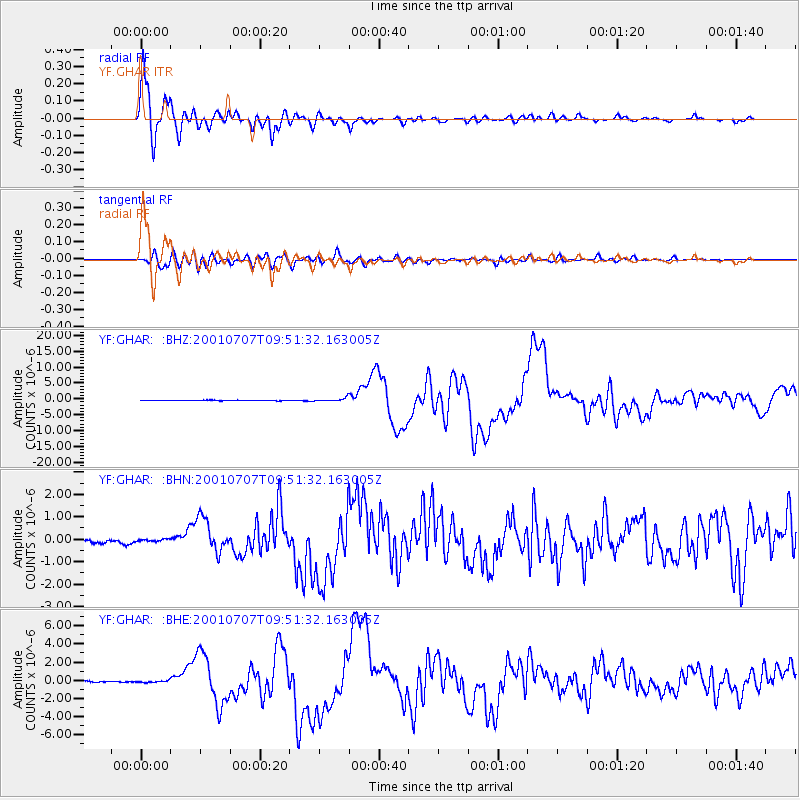
Earthquake location: Near Coast Of Peru
Earthquake latitude/longitude: -17.5/-72.1
Earthquake time(UTC): 2001/07/07 (188) 09:38:43 GMT
Earthquake Depth: 33 km
Earthquake Magnitude: 6.6 MB, 7.3 MS, 7.6 MW, 7.5 ME
Earthquake Catalog/Contributor: WHDF/NEIC
Network: YF Midsea - Mantle Investigation of the Deep Suture between Eurasia and Africa
Station: GHAR YF.GHAR
Lat/Lon: 32.12 N/13.09 E
Elevation: 650 m
Distance: 95.2 deg
Az: 58.099 deg
Baz: 252.664 deg
Ray Param: 0.04083608
Estimated Moho Depth: 12.5 km
Estimated Crust Vp/Vs: 1.63
Assumed Crust Vp: 6.159 km/s
Estimated Crust Vs: 3.785 km/s
Estimated Crust Poisson's Ratio: 0.20
Radial Match: 97.92817 %
Radial Bump: 400
Transverse Match: 82.95932 %
Transverse Bump: 400
SOD ConfigId: 16820
Insert Time: 2010-03-08 22:37:05.092 +0000
GWidth: 2.5
Max Bumps: 400
Tol: 0.001

Signal To Noise

ChannelStoNSTALTA
YF:GHAR: :BHN:20010707T09:51:32.163005Z0.274201484.9150586E-81.792499E-7
YF:GHAR: :BHE:20010707T09:51:32.163005Z1.0870479.272786E-88.530253E-8
YF:GHAR: :BHZ:20010707T09:51:32.163005Z6.18840845.27628E-78.5260695E-8
Arrivals
Ps1.3 SECOND
PpPs5.2 SECOND
PsPs/PpSs6.5 SECOND