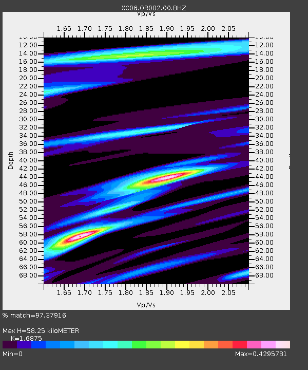
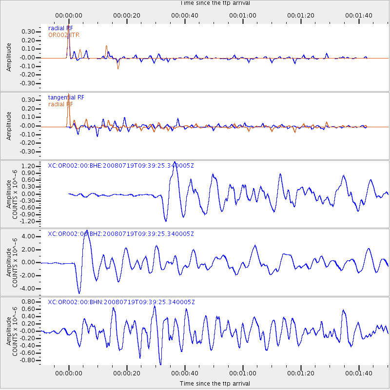
OR002 OR002 - Earthquake Result Viewer

Earthquake location: Santa Cruz Islands Region
Earthquake latitude/longitude: -11.0/164.5
Earthquake time(UTC): 2008/07/19 (201) 09:27:01 GMT
Earthquake Depth: 11 km
Earthquake Magnitude: 6.1 MB, 6.4 MS, 6.6 MW, 6.6 MW
Earthquake Catalog/Contributor: WHDF/NEIC
Network: XC High Lava Plains Broadband Seismic Experiment
Station: OR002 OR002
Lat/Lon: 45.02 N/117.87 W
Elevation: 1019 m
Distance: 89.1 deg
Az: 43.855 deg
Baz: 253.548 deg
Ray Param: 0.042064376
Estimated Moho Depth: 58.25 km
Estimated Crust Vp/Vs: 1.69
Assumed Crust Vp: 6.571 km/s
Estimated Crust Vs: 3.894 km/s
Estimated Crust Poisson's Ratio: 0.23
Radial Match: 97.37916 %
Radial Bump: 216
Transverse Match: 90.185814 %
Transverse Bump: 400
SOD ConfigId: 2504
Insert Time: 2010-02-26 14:57:05.964 +0000
GWidth: 2.5
Max Bumps: 400
Tol: 0.001

Signal To Noise

ChannelStoNSTALTA
XC:OR002:00:BHZ:20080719T09:39:25.340005Z39.7427022.0586338E-65.1799034E-8
XC:OR002:00:BHN:20080719T09:39:25.340005Z4.8263731.6986861E-73.5195917E-8
XC:OR002:00:BHE:20080719T09:39:25.340005Z14.3206175.1658526E-73.6072837E-8
Arrivals
Ps6.2 SECOND
PpPs23 SECOND
PsPs/PpSs30 SECOND