GHAR YF.GHAR - Earthquake Result Viewer
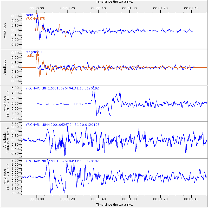
Earthquake location: Near Coast Of Peru
Earthquake latitude/longitude: -17.7/-71.6
Earthquake time(UTC): 2001/06/26 (177) 04:18:31 GMT
Earthquake Depth: 24 km
Earthquake Magnitude: 6.2 MB, 6.7 MS, 6.8 MW, 6.7 ME
Earthquake Catalog/Contributor: WHDF/NEIC
Network: YF Midsea - Mantle Investigation of the Deep Suture between Eurasia and Africa
Station: GHAR YF.GHAR
Lat/Lon: 32.12 N/13.09 E
Elevation: 650 m
Distance: 94.9 deg
Az: 58.005 deg
Baz: 252.276 deg
Ray Param: 0.040905774
Estimated Moho Depth: 13.0 km
Estimated Crust Vp/Vs: 1.60
Assumed Crust Vp: 6.159 km/s
Estimated Crust Vs: 3.85 km/s
Estimated Crust Poisson's Ratio: 0.18
Radial Match: 95.929474 %
Radial Bump: 400
Transverse Match: 85.35619 %
Transverse Bump: 400
SOD ConfigId: 16820
Insert Time: 2010-03-08 22:37:11.642 +0000
GWidth: 2.5
Max Bumps: 400
Tol: 0.001

Signal To Noise

ChannelStoNSTALTA
YF:GHAR: :BHN:20010626T04:31:20.012019Z0.836325355.782145E-86.9137506E-8
YF:GHAR: :BHE:20010626T04:31:20.012019Z0.810566965.4077365E-86.671548E-8
YF:GHAR: :BHZ:20010626T04:31:20.012019Z1.66622541.4486402E-78.6941434E-8
Arrivals
Ps1.3 SECOND
PpPs5.4 SECOND
PsPs/PpSs6.7 SECOND