ITHO YF.ITHO - Earthquake Result Viewer
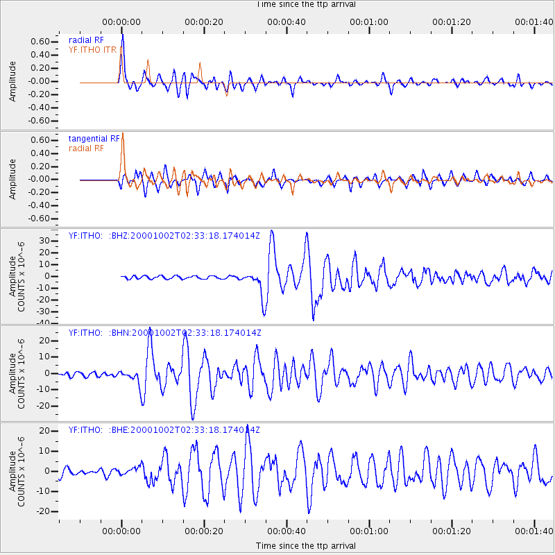
Earthquake location: Lake Tanganyika Region
Earthquake latitude/longitude: -8.0/30.7
Earthquake time(UTC): 2000/10/02 (276) 02:25:31 GMT
Earthquake Depth: 34 km
Earthquake Magnitude: 6.1 MB, 6.7 MS, 6.5 MW, 6.2 ME
Earthquake Catalog/Contributor: WHDF/NEIC
Network: YF Midsea - Mantle Investigation of the Deep Suture between Eurasia and Africa
Station: ITHO YF.ITHO
Lat/Lon: 37.18 N/21.93 E
Elevation: 400 m
Distance: 45.7 deg
Az: 350.182 deg
Baz: 167.792 deg
Ray Param: 0.07105711
Estimated Moho Depth: 29.5 km
Estimated Crust Vp/Vs: 2.02
Assumed Crust Vp: 5.627 km/s
Estimated Crust Vs: 2.786 km/s
Estimated Crust Poisson's Ratio: 0.34
Radial Match: 89.91588 %
Radial Bump: 400
Transverse Match: 85.2945 %
Transverse Bump: 400
SOD ConfigId: 16820
Insert Time: 2010-03-08 22:38:09.234 +0000
GWidth: 2.5
Max Bumps: 400
Tol: 0.001

Signal To Noise

ChannelStoNSTALTA
YF:ITHO: :BHN:20001002T02:33:18.174014Z3.58027534.718214E-61.3178354E-6
YF:ITHO: :BHE:20001002T02:33:18.174014Z1.20982221.9799513E-61.6365639E-6
YF:ITHO: :BHZ:20001002T02:33:18.174014Z9.6841991.203698E-51.2429504E-6
Arrivals
Ps5.6 SECOND
PpPs15 SECOND
PsPs/PpSs21 SECOND