ITHO YF.ITHO - Earthquake Result Viewer
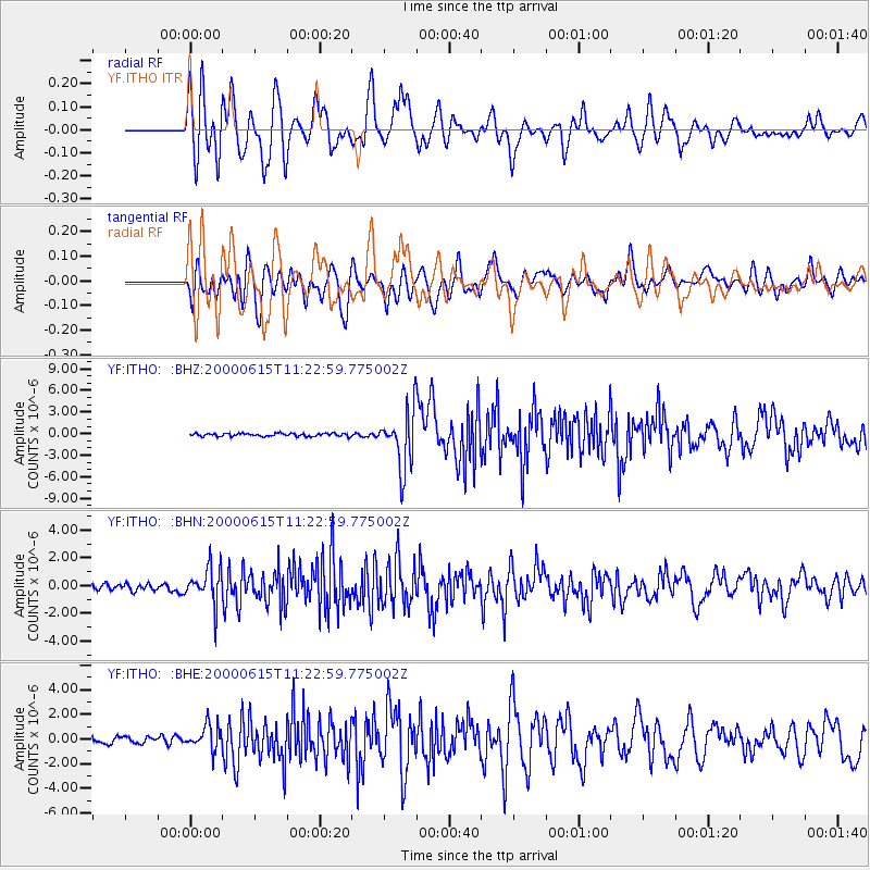
Earthquake location: Southeast Of Shikoku, Japan
Earthquake latitude/longitude: 29.4/132.1
Earthquake time(UTC): 2000/06/15 (167) 11:10:46 GMT
Earthquake Depth: 10 km
Earthquake Magnitude: 6.0 MB, 5.6 MS, 6.1 MW, 6.1 MW
Earthquake Catalog/Contributor: WHDF/NEIC
Network: YF Midsea - Mantle Investigation of the Deep Suture between Eurasia and Africa
Station: ITHO YF.ITHO
Lat/Lon: 37.18 N/21.93 E
Elevation: 400 m
Distance: 86.9 deg
Az: 311.335 deg
Baz: 55.145 deg
Ray Param: 0.043683935
Estimated Moho Depth: 13.0 km
Estimated Crust Vp/Vs: 1.81
Assumed Crust Vp: 5.627 km/s
Estimated Crust Vs: 3.109 km/s
Estimated Crust Poisson's Ratio: 0.28
Radial Match: 92.52409 %
Radial Bump: 400
Transverse Match: 84.39565 %
Transverse Bump: 400
SOD ConfigId: 16820
Insert Time: 2010-03-08 22:38:25.631 +0000
GWidth: 2.5
Max Bumps: 400
Tol: 0.001

Signal To Noise

ChannelStoNSTALTA
YF:ITHO: :BHN:20000615T11:22:59.775002Z4.4908421.2893869E-62.8711472E-7
YF:ITHO: :BHE:20000615T11:22:59.775002Z3.3593379.998367E-72.9762916E-7
YF:ITHO: :BHZ:20000615T11:22:59.775002Z19.2110923.941661E-62.0517632E-7
Arrivals
Ps1.9 SECOND
PpPs6.4 SECOND
PsPs/PpSs8.3 SECOND