
KOUM YF.KOUM - Earthquake Result Viewer
| ||||||||||||||||||
| ||||||||||||||||||
| ||||||||||||||||||
|
Signal To Noise
| Channel | StoN | STA | LTA |
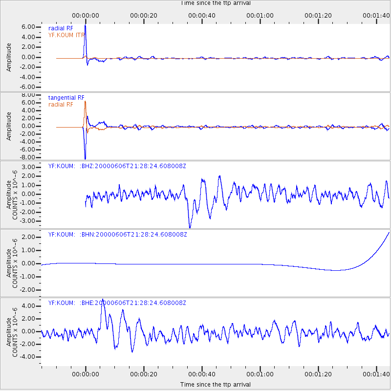
| YF:KOUM: :BHN:20000606T21:28:24.608008Z | 0.93307877 | 3.9038937E-7 | 4.1838845E-7 |
| YF:KOUM: :BHE:20000606T21:28:24.608008Z | 1.0280539 | 6.4729676E-7 | 6.296331E-7 |
| YF:KOUM: :BHZ:20000606T21:28:24.608008Z | 1.0879142 | 4.5984999E-7 | 4.2268957E-7 |
| Arrivals | |
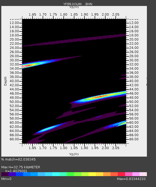
| Ps | 3.4 SECOND |
| PpPs | 14 SECOND |
| PsPs/PpSs | 17 SECOND |

