
KOUM YF.KOUM - Earthquake Result Viewer
| ||||||||||||||||||
| ||||||||||||||||||
| ||||||||||||||||||
|
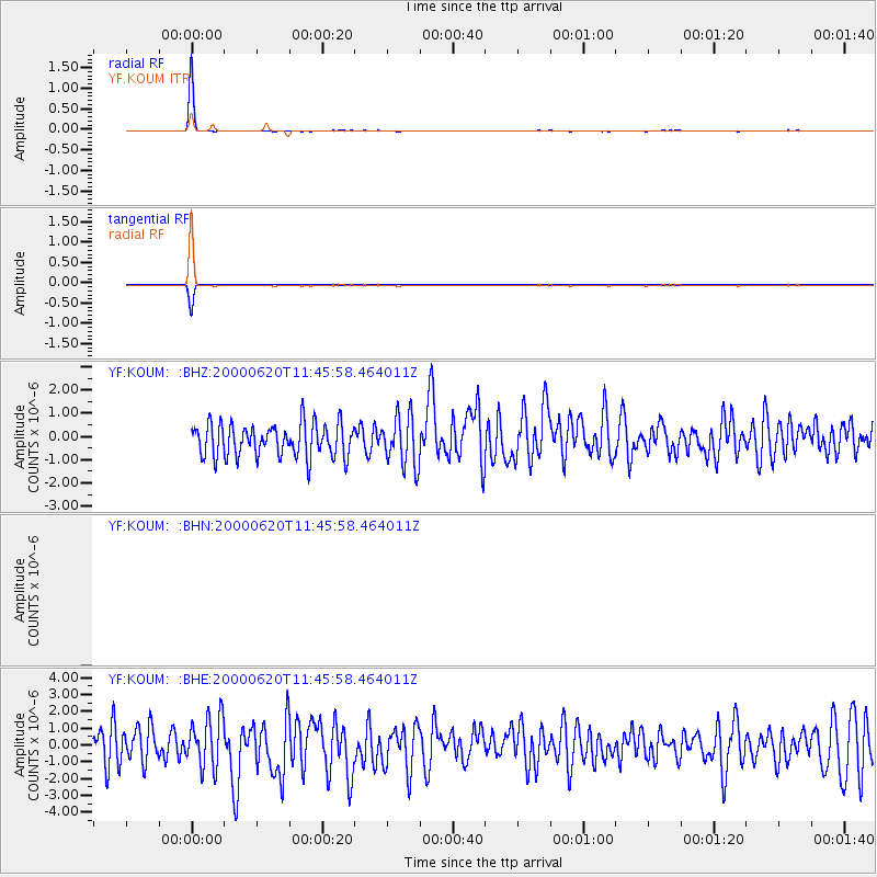
Signal To Noise
| Channel | StoN | STA | LTA |
| $trig.getChannelId() | $trig.getValue() | $trig.getSTA() | $trig.getLTA() |
| YF:KOUM: :BHE:20000620T11:45:58.464011Z | 1.4794874 | 1.4952866E-6 | 1.0106788E-6 |
| YF:KOUM: :BHZ:20000620T11:45:58.464011Z | 1.5105456 | 1.0707491E-6 | 7.0884926E-7 |
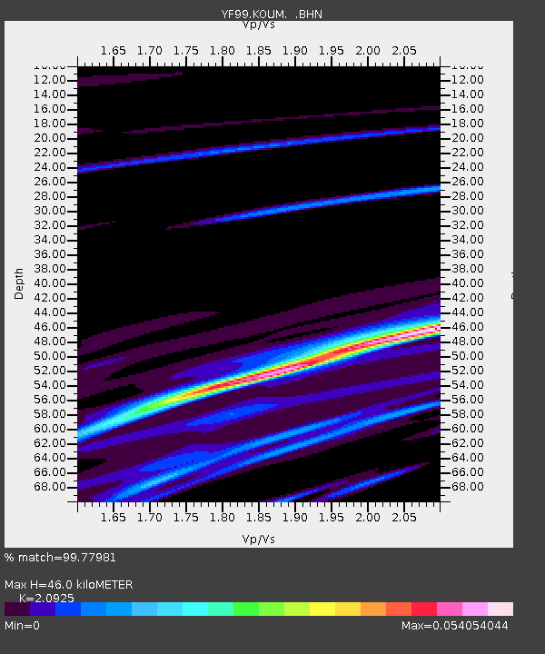
| Arrivals | |
| Ps | 8.5 SECOND |
| PpPs | 23 SECOND |
| PsPs/PpSs | 32 SECOND |

