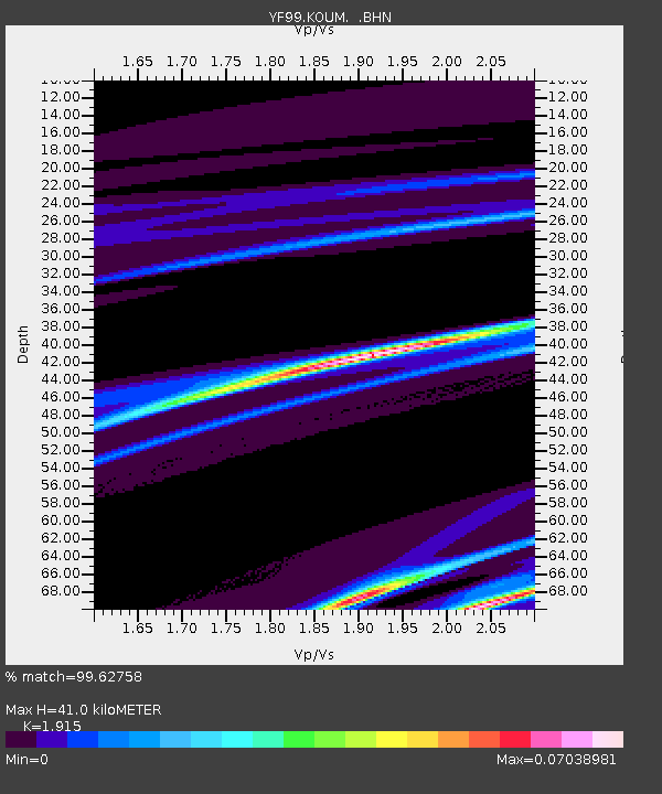
KOUM YF.KOUM - Earthquake Result Viewer
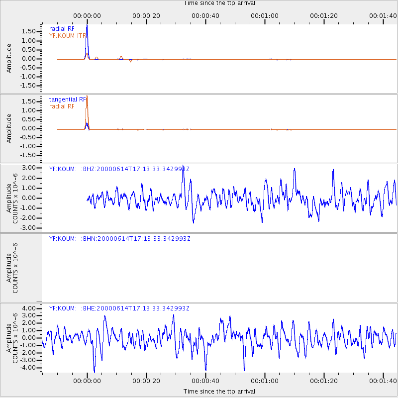
Earthquake location: Talaud Islands, Indonesia
Earthquake latitude/longitude: 4.5/127.7
Earthquake time(UTC): 2000/06/14 (166) 17:00:48 GMT
Earthquake Depth: 90 km
Earthquake Magnitude: 6.1 MB, 5.6 MS, 6.4 MW, 6.3 MW
Earthquake Catalog/Contributor: WHDF/NEIC
Network: YF Midsea - Mantle Investigation of the Deep Suture between Eurasia and Africa
Station: KOUM YF.KOUM
Lat/Lon: 37.70 N/26.84 E
Elevation: 340 m
Distance: 95.8 deg
Az: 308.471 deg
Baz: 79.75 deg
Ray Param: 0.040619306
Estimated Moho Depth: 41.0 km
Estimated Crust Vp/Vs: 1.91
Assumed Crust Vp: 5.989 km/s
Estimated Crust Vs: 3.127 km/s
Estimated Crust Poisson's Ratio: 0.31
Radial Match: 99.62758 %
Radial Bump: 44
Transverse Match: 99.62758 %
Transverse Bump: 44
SOD ConfigId: 3744
Insert Time: 2010-03-08 22:39:00.547 +0000
GWidth: 2.5
Max Bumps: 400
Tol: 0.001

Signal To Noise

ChannelStoNSTALTA
$trig.getChannelId()$trig.getValue()$trig.getSTA()$trig.getLTA()
YF:KOUM: :BHE:20000614T17:13:33.342993Z2.19265411.6413832E-67.485828E-7
YF:KOUM: :BHZ:20000614T17:13:33.342993Z2.15056661.1882951E-65.5254975E-7
Arrivals
Ps6.4 SECOND
PpPs20 SECOND
PsPs/PpSs26 SECOND