
KOUM YF.KOUM - Earthquake Result Viewer
| ||||||||||||||||||
| ||||||||||||||||||
| ||||||||||||||||||
|
Signal To Noise
| Channel | StoN | STA | LTA |
| $trig.getChannelId() | $trig.getValue() | $trig.getSTA() | $trig.getLTA() |
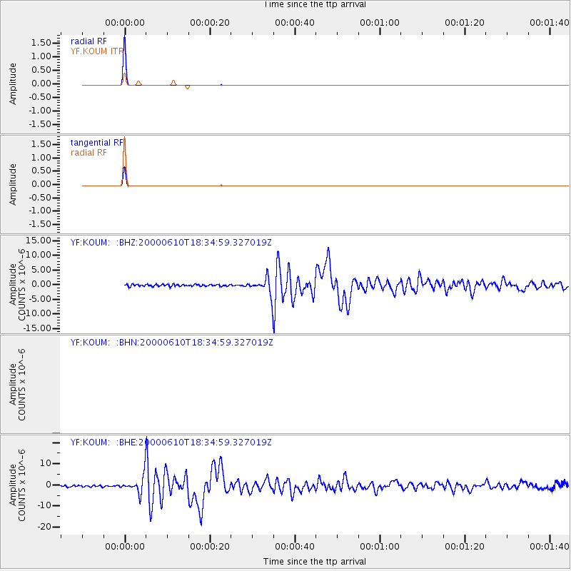
| YF:KOUM: :BHE:20000610T18:34:59.327019Z | 10.786302 | 4.5288502E-6 | 4.198705E-7 |
| YF:KOUM: :BHZ:20000610T18:34:59.327019Z | 10.681796 | 3.1921784E-6 | 2.9884285E-7 |
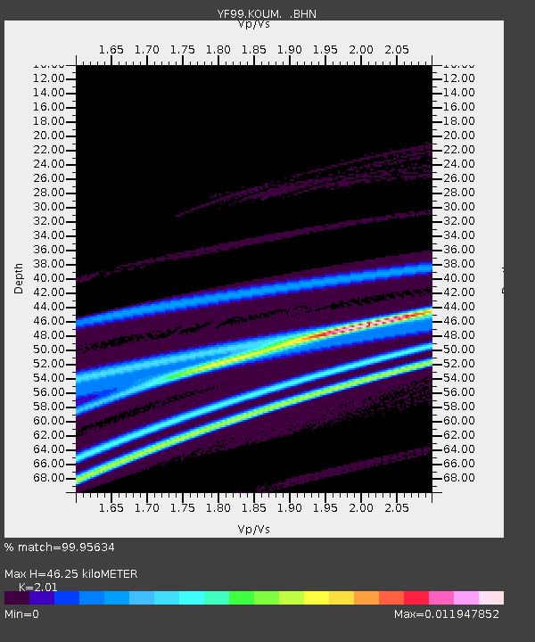
| Arrivals | |
| Ps | 8.0 SECOND |
| PpPs | 23 SECOND |
| PsPs/PpSs | 31 SECOND |

