
KOUM YF.KOUM - Earthquake Result Viewer
| ||||||||||||||||||
| ||||||||||||||||||
| ||||||||||||||||||
|
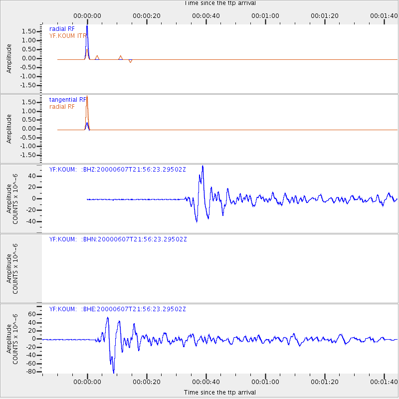
Signal To Noise
| Channel | StoN | STA | LTA |
| $trig.getChannelId() | $trig.getValue() | $trig.getSTA() | $trig.getLTA() |
| YF:KOUM: :BHE:20000607T21:56:23.29502Z | 8.505302 | 3.2218725E-6 | 3.7880753E-7 |
| YF:KOUM: :BHZ:20000607T21:56:23.29502Z | 8.179231 | 2.2579165E-6 | 2.7605486E-7 |
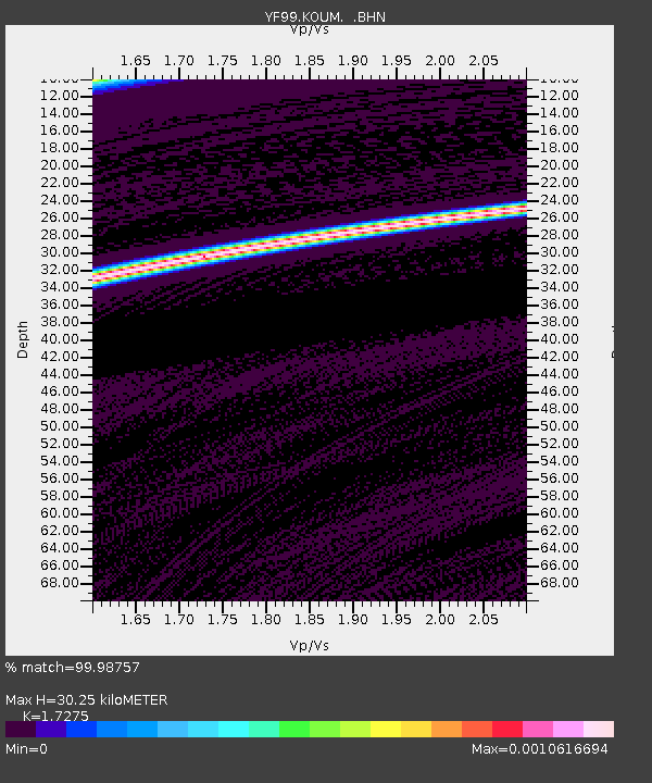
| Arrivals | |
| Ps | 3.8 SECOND |
| PpPs | 13 SECOND |
| PsPs/PpSs | 17 SECOND |

