
KOUM YF.KOUM - Earthquake Result Viewer
| ||||||||||||||||||
| ||||||||||||||||||
| ||||||||||||||||||
|
Signal To Noise
| Channel | StoN | STA | LTA |
| $trig.getChannelId() | $trig.getValue() | $trig.getSTA() | $trig.getLTA() |
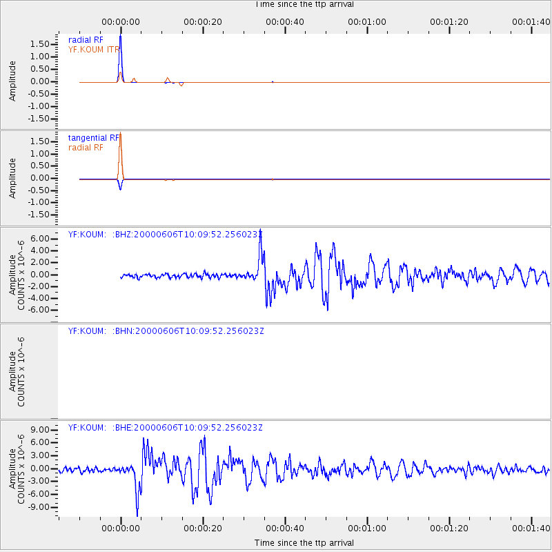
| YF:KOUM: :BHE:20000606T10:09:52.256023Z | 8.453298 | 3.3762412E-6 | 3.9939928E-7 |
| YF:KOUM: :BHZ:20000606T10:09:52.256023Z | 8.237183 | 2.3750126E-6 | 2.8832824E-7 |
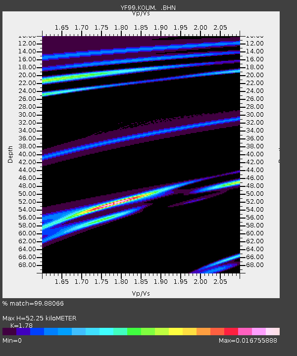
| Arrivals | |
| Ps | 7.0 SECOND |
| PpPs | 24 SECOND |
| PsPs/PpSs | 31 SECOND |

