
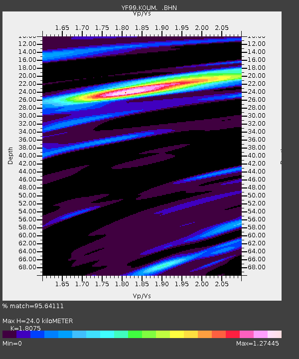
KOUM YF.KOUM - Earthquake Result Viewer
| ||||||||||||||||||
| ||||||||||||||||||
| ||||||||||||||||||
|
Signal To Noise
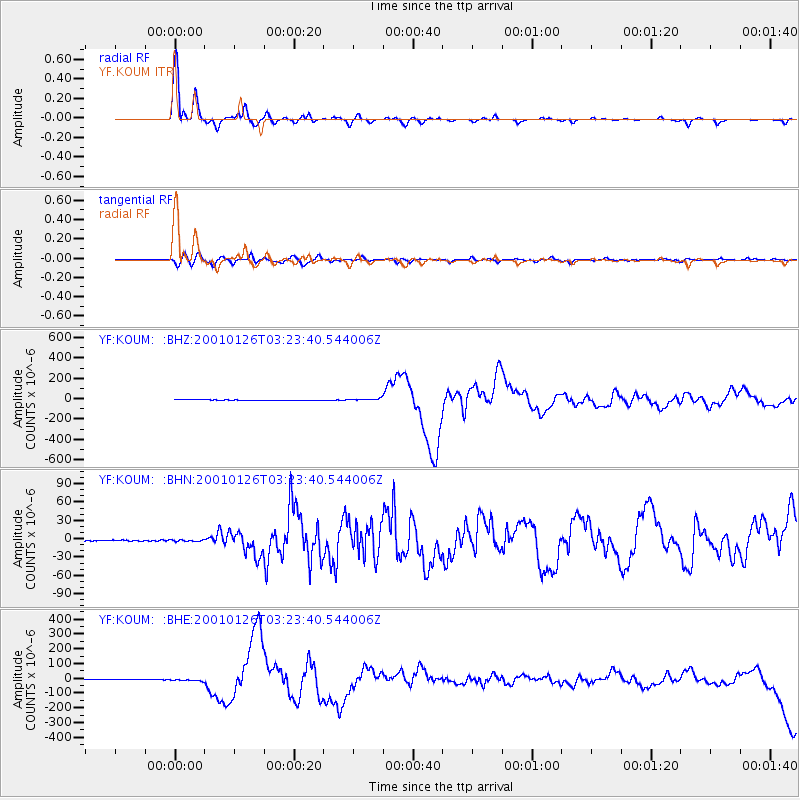
| Channel | StoN | STA | LTA |
| YF:KOUM: :BHN:20010126T03:23:40.544006Z | 1.6829743 | 1.34214E-6 | 7.9748094E-7 |
| YF:KOUM: :BHE:20010126T03:23:40.544006Z | 7.4333334 | 6.08827E-6 | 8.190497E-7 |
| YF:KOUM: :BHZ:20010126T03:23:40.544006Z | 6.3378406 | 1.0084871E-5 | 1.5912158E-6 |
| Arrivals | |
| Ps | 3.4 SECOND |
| PpPs | 11 SECOND |
| PsPs/PpSs | 14 SECOND |

