
KOUM YF.KOUM - Earthquake Result Viewer
| ||||||||||||||||||
| ||||||||||||||||||
| ||||||||||||||||||
|
Signal To Noise
| Channel | StoN | STA | LTA |
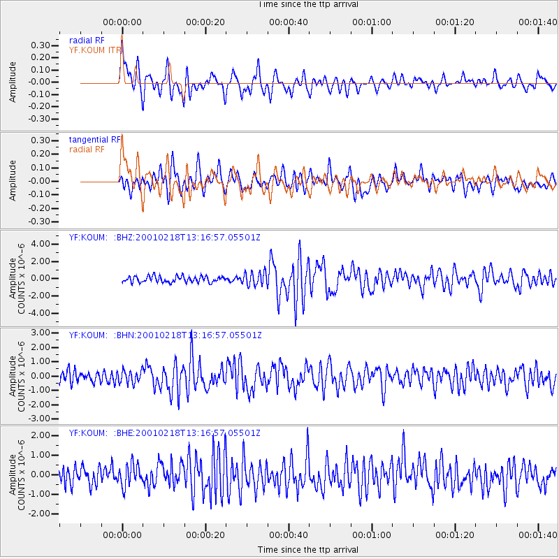
| YF:KOUM: :BHN:20010218T13:16:57.05501Z | 1.1399177 | 4.4378305E-7 | 3.8931145E-7 |
| YF:KOUM: :BHE:20010218T13:16:57.05501Z | 1.4941651 | 5.580126E-7 | 3.7346112E-7 |
| YF:KOUM: :BHZ:20010218T13:16:57.05501Z | 2.248117 | 7.725503E-7 | 3.4364328E-7 |
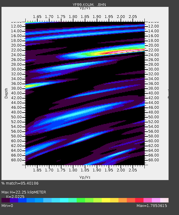
| Arrivals | |
| Ps | 3.9 SECOND |
| PpPs | 11 SECOND |
| PsPs/PpSs | 15 SECOND |

