
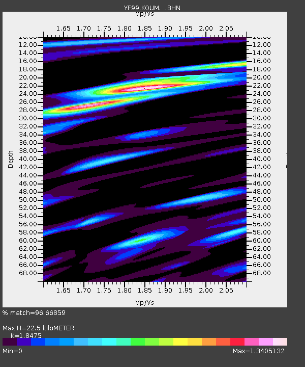
KOUM YF.KOUM - Earthquake Result Viewer
| ||||||||||||||||||
| ||||||||||||||||||
| ||||||||||||||||||
|
Signal To Noise
| Channel | StoN | STA | LTA |
| YF:KOUM: :BHN:20010110T16:14:47.967Z | 7.999436 | 2.5827171E-6 | 3.2286238E-7 |
| YF:KOUM: :BHE:20010110T16:14:47.967Z | 1.5145465 | 5.3150865E-7 | 3.5093584E-7 |
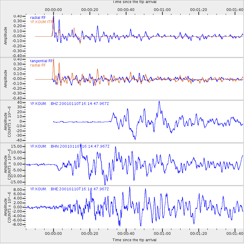
| YF:KOUM: :BHZ:20010110T16:14:47.967Z | 16.229773 | 8.494095E-6 | 5.23365E-7 |
| Arrivals | |
| Ps | 3.2 SECOND |
| PpPs | 10 SECOND |
| PsPs/PpSs | 14 SECOND |

