
MARJ YF.MARJ - Earthquake Result Viewer
| ||||||||||||||||||
| ||||||||||||||||||
| ||||||||||||||||||
|
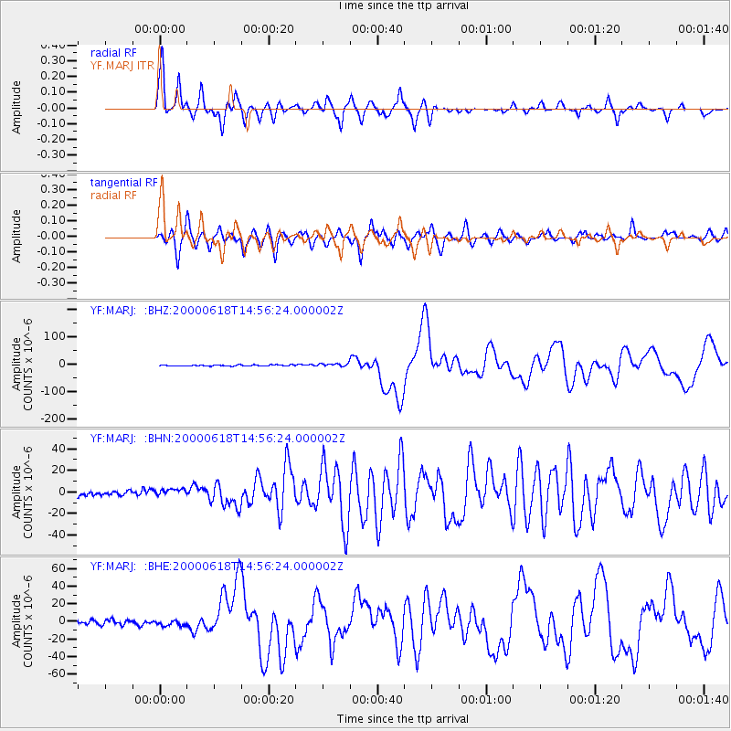
Signal To Noise
| Channel | StoN | STA | LTA |
| YF:MARJ: :BHN:20000618T14:56:24.000002Z | 1.6419495 | 5.386631E-6 | 3.2806313E-6 |
| YF:MARJ: :BHE:20000618T14:56:24.000002Z | 1.2166448 | 3.1768182E-6 | 2.6111304E-6 |
| YF:MARJ: :BHZ:20000618T14:56:24.000002Z | 2.7332373 | 5.752213E-6 | 2.104542E-6 |
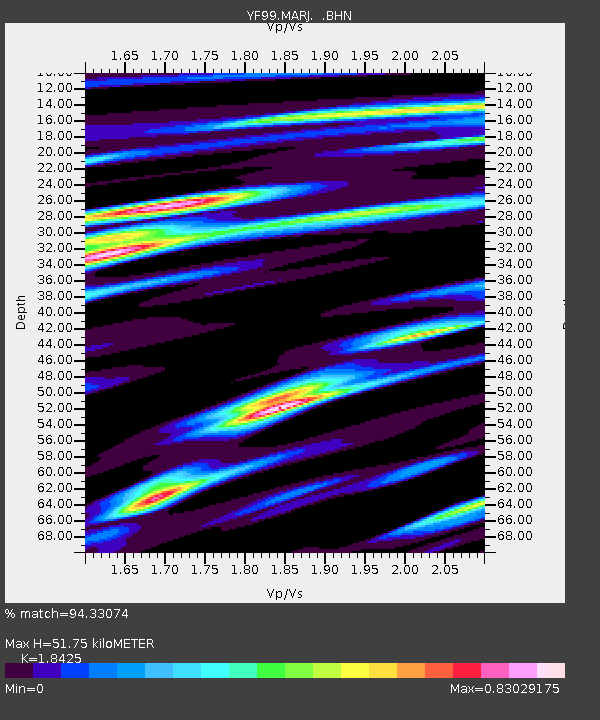
| Arrivals | |
| Ps | 7.8 SECOND |
| PpPs | 26 SECOND |
| PsPs/PpSs | 33 SECOND |

