
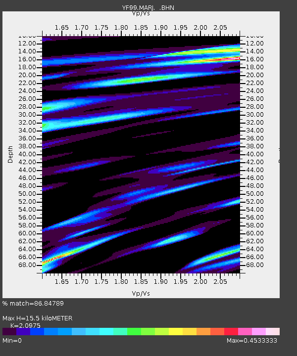
MARJ YF.MARJ - Earthquake Result Viewer
| ||||||||||||||||||
| ||||||||||||||||||
| ||||||||||||||||||
|
Signal To Noise
| Channel | StoN | STA | LTA |
| YF:MARJ: :BHN:20000607T23:57:27.135017Z | 1.390965 | 1.2031114E-6 | 8.6494725E-7 |
| YF:MARJ: :BHE:20000607T23:57:27.135017Z | 1.2363318 | 1.0142666E-6 | 8.203838E-7 |
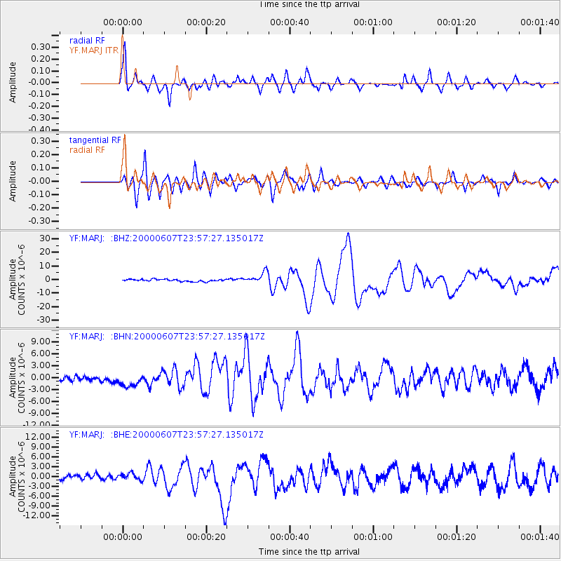
| YF:MARJ: :BHZ:20000607T23:57:27.135017Z | 5.557213 | 4.2543493E-6 | 7.6555443E-7 |
| Arrivals | |
| Ps | 3.1 SECOND |
| PpPs | 8.4 SECOND |
| PsPs/PpSs | 11 SECOND |

