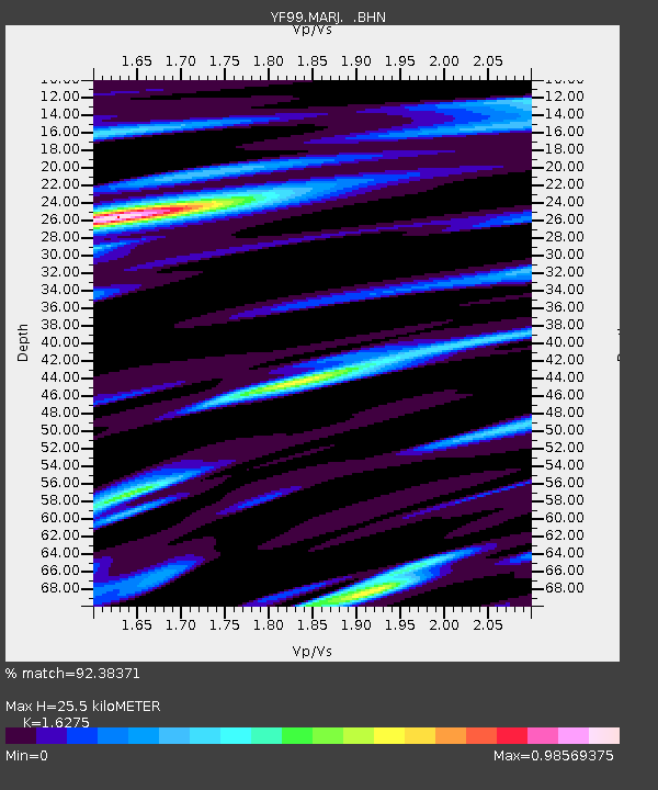
MARJ YF.MARJ - Earthquake Result Viewer
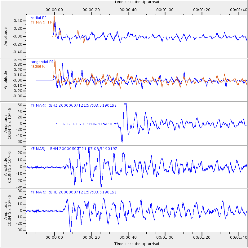
Earthquake location: Myanmar
Earthquake latitude/longitude: 26.9/97.2
Earthquake time(UTC): 2000/06/07 (159) 21:46:55 GMT
Earthquake Depth: 33 km
Earthquake Magnitude: 6.3 MB, 6.5 MS, 6.4 MW, 6.4 MW
Earthquake Catalog/Contributor: WHDF/NEIC
Network: YF Midsea - Mantle Investigation of the Deep Suture between Eurasia and Africa
Station: MARJ YF.MARJ
Lat/Lon: 32.52 N/20.88 E
Elevation: 300 m
Distance: 65.3 deg
Az: 295.324 deg
Baz: 72.912 deg
Ray Param: 0.058331456
Estimated Moho Depth: 25.5 km
Estimated Crust Vp/Vs: 1.63
Assumed Crust Vp: 5.657 km/s
Estimated Crust Vs: 3.476 km/s
Estimated Crust Poisson's Ratio: 0.20
Radial Match: 92.38371 %
Radial Bump: 400
Transverse Match: 90.2432 %
Transverse Bump: 400
SOD ConfigId: 16820
Insert Time: 2010-03-08 22:39:51.175 +0000
GWidth: 2.5
Max Bumps: 400
Tol: 0.001

Signal To Noise

ChannelStoNSTALTA
YF:MARJ: :BHN:20000607T21:57:03.519019Z0.995739944.689151E-74.7092126E-7
YF:MARJ: :BHE:20000607T21:57:03.519019Z1.37429426.8196823E-74.962316E-7
YF:MARJ: :BHZ:20000607T21:57:03.519019Z4.0484892.0137481E-64.974073E-7
Arrivals
Ps2.9 SECOND
PpPs11 SECOND
PsPs/PpSs14 SECOND