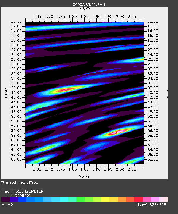
Y35 Y35 - Earthquake Result Viewer
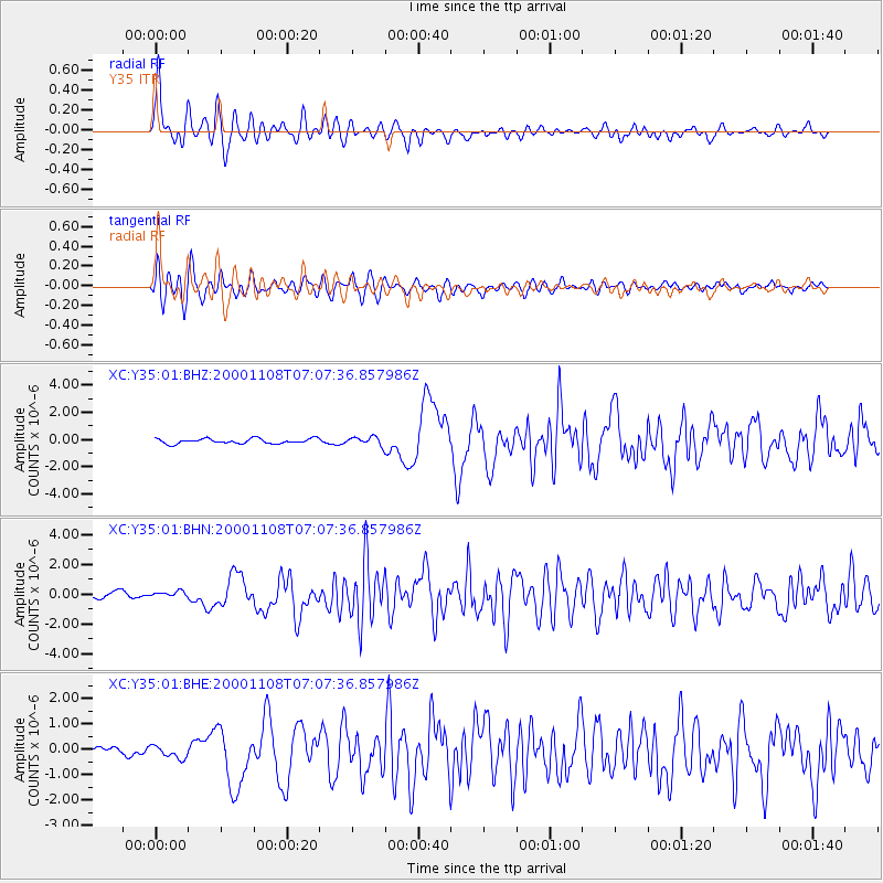
Earthquake location: Panama-Colombia Border Region
Earthquake latitude/longitude: 7.0/-77.8
Earthquake time(UTC): 2000/11/08 (313) 06:59:58 GMT
Earthquake Depth: 17 km
Earthquake Magnitude: 6.0 MB, 6.4 MS, 6.5 MW, 6.2 ML
Earthquake Catalog/Contributor: WHDF/NEIC
Network: XC Yellowstone Intermountain Seismic Array
Station: Y35 Y35
Lat/Lon: 42.57 N/108.04 W
Elevation: 2062 m
Distance: 44.3 deg
Az: 327.843 deg
Baz: 134.346 deg
Ray Param: 0.07198551
Estimated Moho Depth: 56.5 km
Estimated Crust Vp/Vs: 1.98
Assumed Crust Vp: 6.161 km/s
Estimated Crust Vs: 3.108 km/s
Estimated Crust Poisson's Ratio: 0.33
Radial Match: 91.89905 %
Radial Bump: 400
Transverse Match: 79.85934 %
Transverse Bump: 400
SOD ConfigId: 3744
Insert Time: 2010-02-26 14:57:16.349 +0000
GWidth: 2.5
Max Bumps: 400
Tol: 0.001

Signal To Noise

ChannelStoNSTALTA
XC:Y35:01:BHN:20001108T07:07:36.857986Z0.85521321.8501218E-72.1633457E-7
XC:Y35:01:BHE:20001108T07:07:36.857986Z1.59811512.39867E-71.500937E-7
XC:Y35:01:BHZ:20001108T07:07:36.857986Z1.65778433.0449547E-71.8367616E-7
Arrivals
Ps9.5 SECOND
PpPs26 SECOND
PsPs/PpSs35 SECOND