
Y35 Y35 - Earthquake Result Viewer
| ||||||||||||||||||
| ||||||||||||||||||
| ||||||||||||||||||
|
Signal To Noise
| Channel | StoN | STA | LTA |
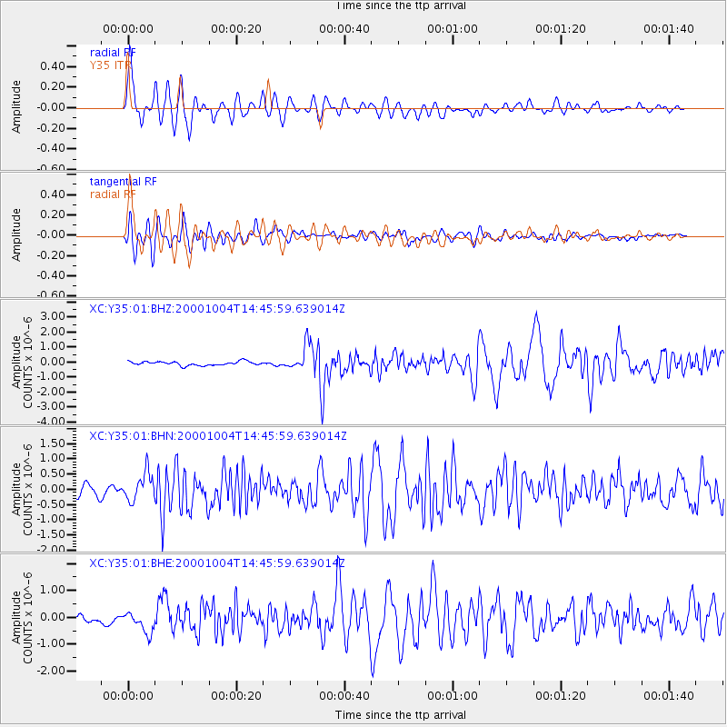
| XC:Y35:01:BHN:20001004T14:45:59.639014Z | 2.2556798 | 4.57725E-7 | 2.0292109E-7 |
| XC:Y35:01:BHE:20001004T14:45:59.639014Z | 2.5012212 | 3.975515E-7 | 1.5894297E-7 |
| XC:Y35:01:BHZ:20001004T14:45:59.639014Z | 7.037302 | 9.1660314E-7 | 1.3024923E-7 |
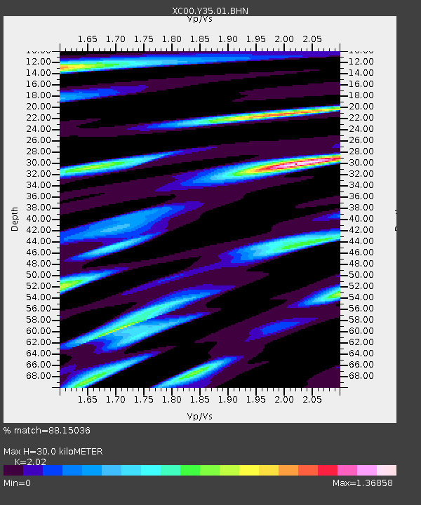
| Arrivals | |
| Ps | 5.2 SECOND |
| PpPs | 14 SECOND |
| PsPs/PpSs | 19 SECOND |

