
Y35 Y35 - Earthquake Result Viewer
| ||||||||||||||||||
| ||||||||||||||||||
| ||||||||||||||||||
|
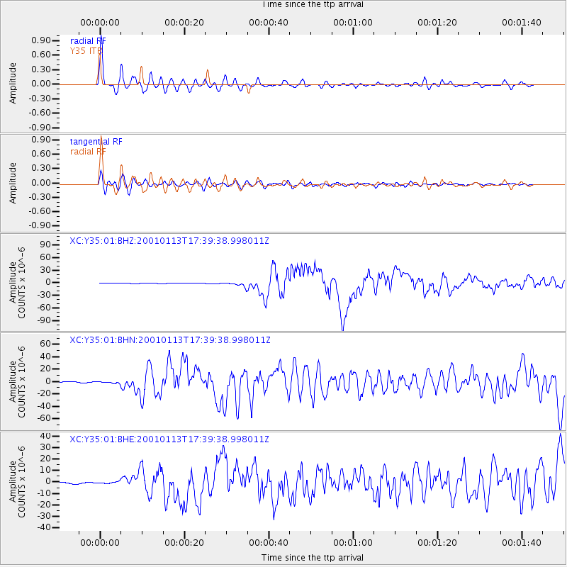
Signal To Noise
| Channel | StoN | STA | LTA |
| XC:Y35:01:BHN:20010113T17:39:38.998011Z | 3.5539713 | 1.7221477E-6 | 4.845699E-7 |
| XC:Y35:01:BHE:20010113T17:39:38.998011Z | 1.9892161 | 1.0902731E-6 | 5.4809186E-7 |
| XC:Y35:01:BHZ:20010113T17:39:38.998011Z | 13.916366 | 5.1694215E-6 | 3.7146347E-7 |
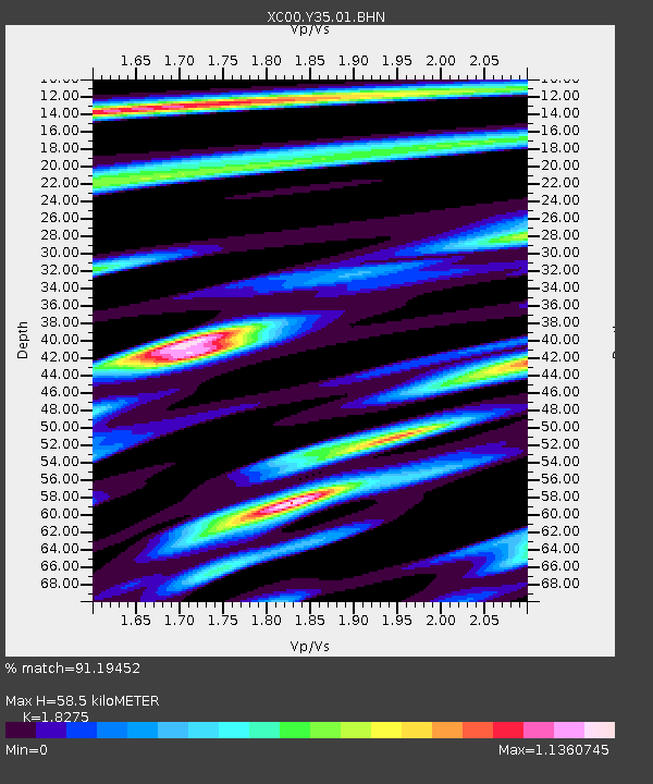
| Arrivals | |
| Ps | 8.4 SECOND |
| PpPs | 25 SECOND |
| PsPs/PpSs | 33 SECOND |

