Y17 Y17 - Earthquake Result Viewer
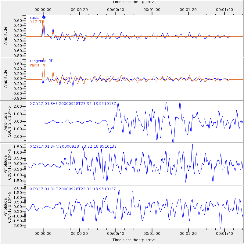
Earthquake location: Near Coast Of Ecuador
Earthquake latitude/longitude: -0.2/-80.6
Earthquake time(UTC): 2000/09/28 (272) 23:23:43 GMT
Earthquake Depth: 23 km
Earthquake Magnitude: 5.8 MB, 6.0 MS, 6.6 MW, 6.4 MW
Earthquake Catalog/Contributor: WHDF/NEIC
Network: XC Yellowstone Intermountain Seismic Array
Station: Y17 Y17
Lat/Lon: 44.10 N/111.19 W
Elevation: 1762 m
Distance: 51.9 deg
Az: 332.203 deg
Baz: 139.664 deg
Ray Param: 0.06709967
Estimated Moho Depth: 53.5 km
Estimated Crust Vp/Vs: 1.64
Assumed Crust Vp: 6.35 km/s
Estimated Crust Vs: 3.878 km/s
Estimated Crust Poisson's Ratio: 0.20
Radial Match: 84.296814 %
Radial Bump: 400
Transverse Match: 82.54795 %
Transverse Bump: 400
SOD ConfigId: 3744
Insert Time: 2010-02-26 14:57:29.087 +0000
GWidth: 2.5
Max Bumps: 400
Tol: 0.001

Signal To Noise

ChannelStoNSTALTA
XC:Y17:01:BHN:20000928T23:32:18.951013Z0.60455691.288046E-72.130562E-7
XC:Y17:01:BHE:20000928T23:32:18.951013Z0.5163358.3289365E-81.6130876E-7
XC:Y17:01:BHZ:20000928T23:32:18.951013Z1.54751071.6965757E-71.09632566E-7
Arrivals
Ps5.7 SECOND
PpPs21 SECOND
PsPs/PpSs27 SECOND