Y17 Y17 - Earthquake Result Viewer
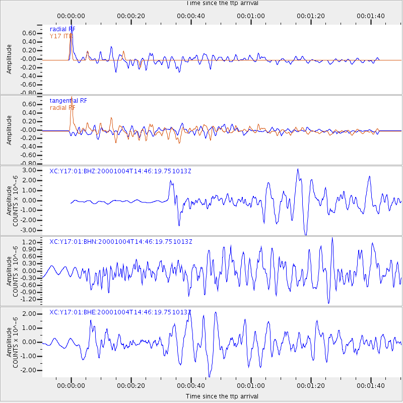
Earthquake location: Windward Islands
Earthquake latitude/longitude: 11.1/-62.6
Earthquake time(UTC): 2000/10/04 (278) 14:37:44 GMT
Earthquake Depth: 110 km
Earthquake Magnitude: 5.6 MB, 5.4 MS, 6.1 MW, 5.9 MD
Earthquake Catalog/Contributor: WHDF/NEIC
Network: XC Yellowstone Intermountain Seismic Array
Station: Y17 Y17
Lat/Lon: 44.10 N/111.19 W
Elevation: 1762 m
Distance: 53.1 deg
Az: 317.466 deg
Baz: 112.942 deg
Ray Param: 0.06596056
Estimated Moho Depth: 58.0 km
Estimated Crust Vp/Vs: 2.03
Assumed Crust Vp: 6.35 km/s
Estimated Crust Vs: 3.136 km/s
Estimated Crust Poisson's Ratio: 0.34
Radial Match: 87.47651 %
Radial Bump: 400
Transverse Match: 68.0031 %
Transverse Bump: 400
SOD ConfigId: 16820
Insert Time: 2010-02-26 14:57:33.031 +0000
GWidth: 2.5
Max Bumps: 400
Tol: 0.001

Signal To Noise

ChannelStoNSTALTA
XC:Y17:01:BHN:20001004T14:46:19.751013Z0.992933752.4213227E-72.4385542E-7
XC:Y17:01:BHE:20001004T14:46:19.751013Z4.0710266.0645164E-71.4896776E-7
XC:Y17:01:BHZ:20001004T14:46:19.751013Z9.0131099.262731E-71.0276955E-7
Arrivals
Ps9.8 SECOND
PpPs26 SECOND
PsPs/PpSs36 SECOND