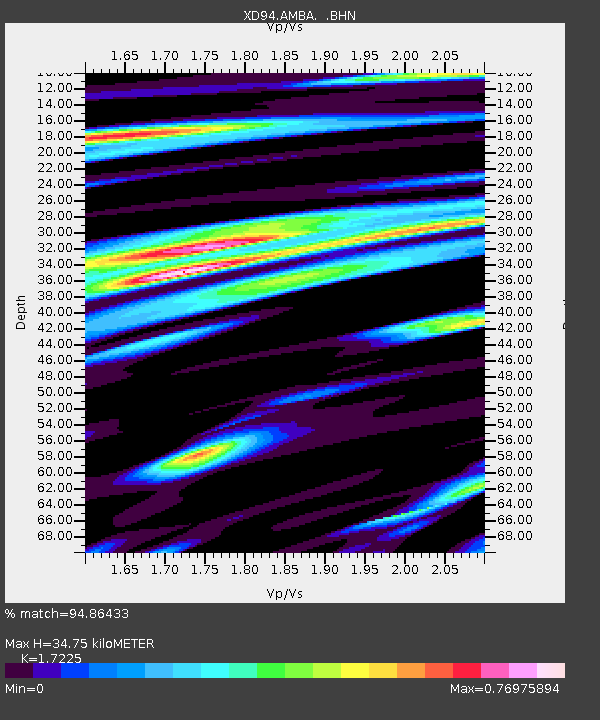
AMBA XD.AMBA - Earthquake Result Viewer
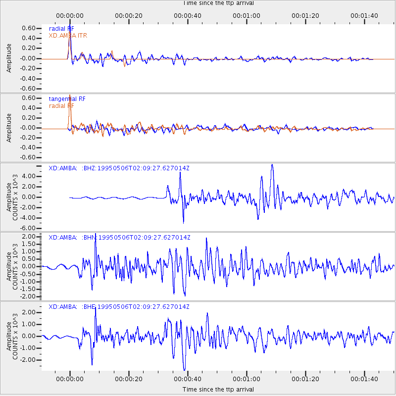
Earthquake location: Myanmar-India Border Region
Earthquake latitude/longitude: 25.0/95.3
Earthquake time(UTC): 1995/05/06 (126) 01:59:07 GMT
Earthquake Depth: 122 km
Earthquake Magnitude: 6.4 MB, 6.5 UNKNOWN, 6.4 MW
Earthquake Catalog/Contributor: WHDF/NEIC
Network: XD Tanzania BB Experiment
Station: AMBA XD.AMBA
Lat/Lon: 8.11 S/33.26 E
Elevation: 1415 m
Distance: 68.8 deg
Az: 249.792 deg
Baz: 59.313 deg
Ray Param: 0.05575533
Estimated Moho Depth: 34.75 km
Estimated Crust Vp/Vs: 1.72
Assumed Crust Vp: 6.502 km/s
Estimated Crust Vs: 3.774 km/s
Estimated Crust Poisson's Ratio: 0.25
Radial Match: 94.86433 %
Radial Bump: 400
Transverse Match: 80.23377 %
Transverse Bump: 400
SOD ConfigId: 6273
Insert Time: 2010-03-08 22:47:05.800 +0000
GWidth: 2.5
Max Bumps: 400
Tol: 0.001

Signal To Noise

ChannelStoNSTALTA
XD:AMBA: :BHN:19950506T02:09:27.627014Z3.14028304.1185696.844406
XD:AMBA: :BHE:19950506T02:09:27.627014Z5.155454372.203572.19606
XD:AMBA: :BHZ:19950506T02:09:27.627014Z6.2837124800.9424127.46324
Arrivals
Ps4.0 SECOND
PpPs14 SECOND
PsPs/PpSs18 SECOND