
Y34 Y34 - Earthquake Result Viewer
| ||||||||||||||||||
| ||||||||||||||||||
| ||||||||||||||||||
|
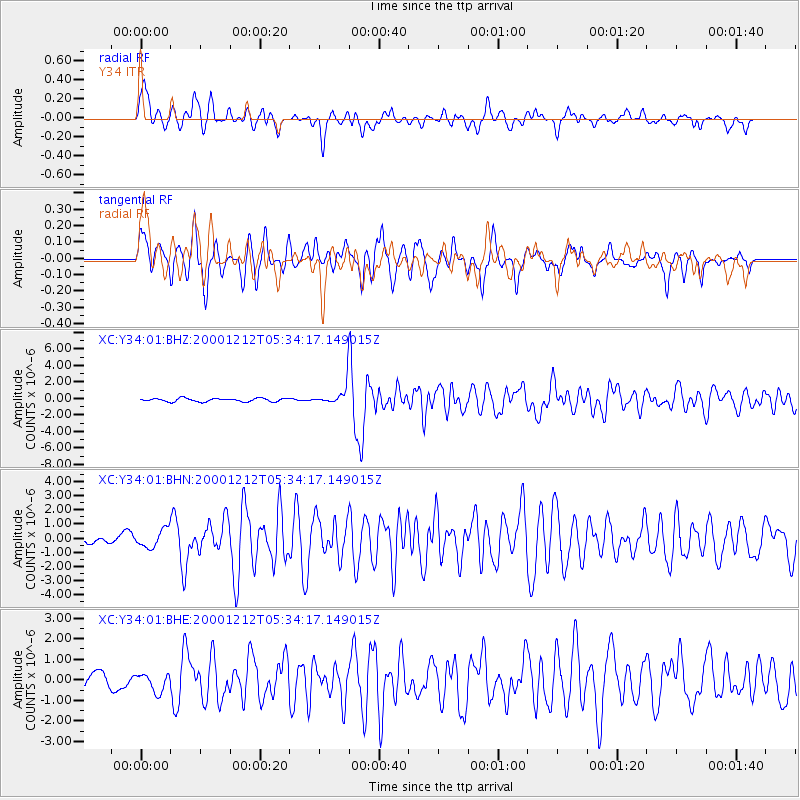
Signal To Noise
| Channel | StoN | STA | LTA |
| XC:Y34:01:BHN:20001212T05:34:17.149015Z | 2.1591215 | 6.5429947E-7 | 3.0303968E-7 |
| XC:Y34:01:BHE:20001212T05:34:17.149015Z | 1.185956 | 4.683352E-7 | 3.94901E-7 |
| XC:Y34:01:BHZ:20001212T05:34:17.149015Z | 4.806281 | 9.707742E-7 | 2.0198031E-7 |
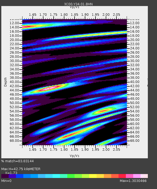
| Arrivals | |
| Ps | 5.4 SECOND |
| PpPs | 18 SECOND |
| PsPs/PpSs | 23 SECOND |

