Y34 Y34 - Earthquake Result Viewer
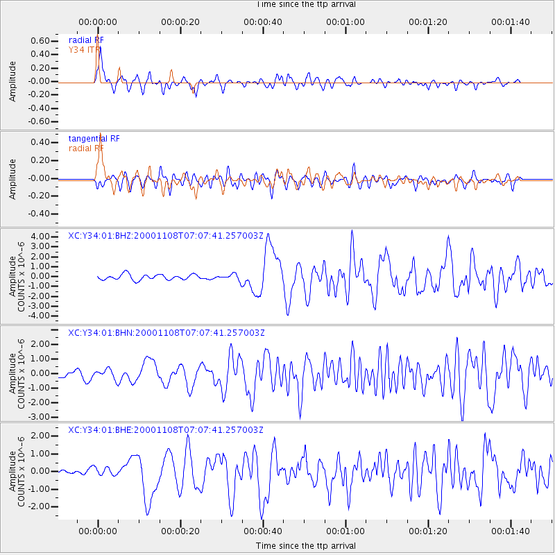
Earthquake location: Panama-Colombia Border Region
Earthquake latitude/longitude: 7.0/-77.8
Earthquake time(UTC): 2000/11/08 (313) 06:59:58 GMT
Earthquake Depth: 17 km
Earthquake Magnitude: 6.0 MB, 6.4 MS, 6.5 MW, 6.2 ML
Earthquake Catalog/Contributor: WHDF/NEIC
Network: XC Yellowstone Intermountain Seismic Array
Station: Y34 Y34
Lat/Lon: 42.97 N/108.56 W
Elevation: 1562 m
Distance: 44.9 deg
Az: 327.875 deg
Baz: 134.016 deg
Ray Param: 0.07164238
Estimated Moho Depth: 15.25 km
Estimated Crust Vp/Vs: 1.62
Assumed Crust Vp: 6.161 km/s
Estimated Crust Vs: 3.809 km/s
Estimated Crust Poisson's Ratio: 0.19
Radial Match: 82.121574 %
Radial Bump: 400
Transverse Match: 63.803482 %
Transverse Bump: 400
SOD ConfigId: 3744
Insert Time: 2010-02-26 14:57:56.420 +0000
GWidth: 2.5
Max Bumps: 400
Tol: 0.001

Signal To Noise

ChannelStoNSTALTA
XC:Y34:01:BHN:20001108T07:07:41.257003Z1.85603853.5015188E-71.8865552E-7
XC:Y34:01:BHE:20001108T07:07:41.257003Z1.06564162.3884752E-72.2413492E-7
XC:Y34:01:BHZ:20001108T07:07:41.257003Z1.14357723.1220597E-72.7300823E-7
Arrivals
Ps1.6 SECOND
PpPs6.1 SECOND
PsPs/PpSs7.7 SECOND