
Y34 Y34 - Earthquake Result Viewer
| ||||||||||||||||||
| ||||||||||||||||||
| ||||||||||||||||||
|
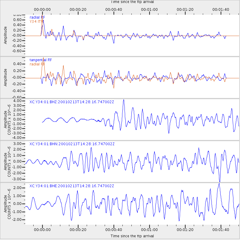
Signal To Noise
| Channel | StoN | STA | LTA |
| XC:Y34:01:BHN:20010213T14:28:16.747002Z | 0.725448 | 2.5122156E-7 | 3.4629852E-7 |
| XC:Y34:01:BHE:20010213T14:28:16.747002Z | 0.39734316 | 1.9721219E-7 | 4.963271E-7 |
| XC:Y34:01:BHZ:20010213T14:28:16.747002Z | 0.78699005 | 2.4379594E-7 | 3.0978276E-7 |
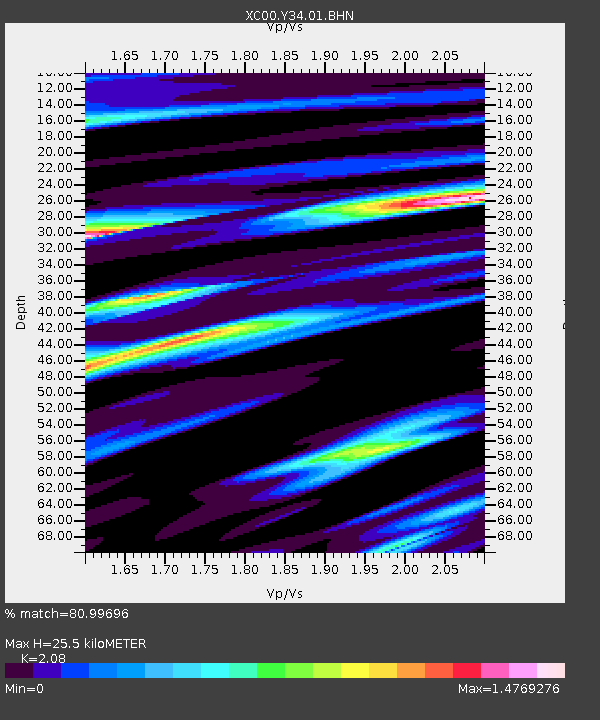
| Arrivals | |
| Ps | 4.7 SECOND |
| PpPs | 12 SECOND |
| PsPs/PpSs | 17 SECOND |

