Y15 Y15 - Earthquake Result Viewer
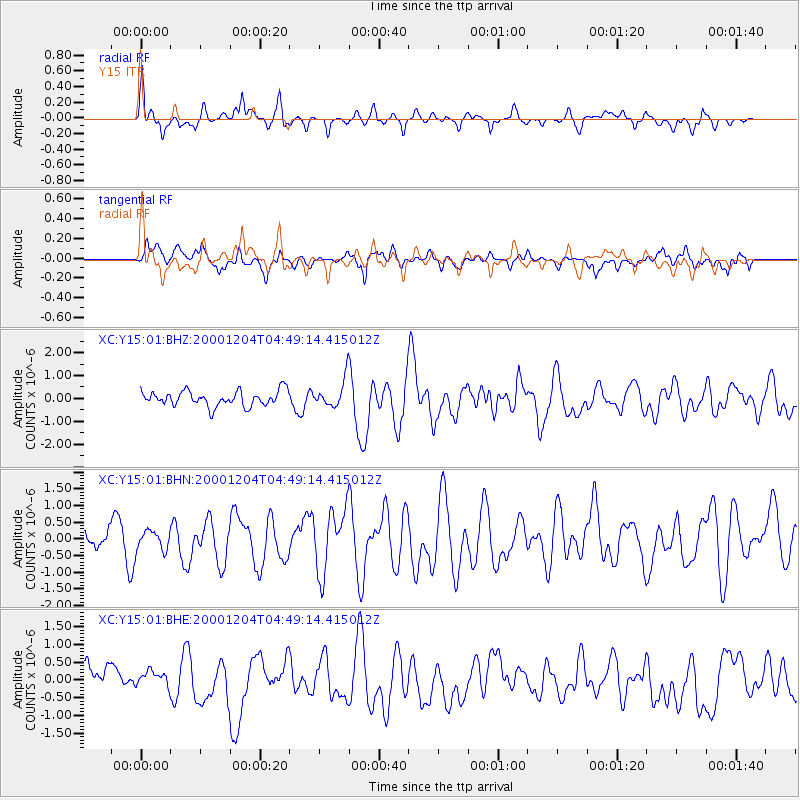
Earthquake location: Near Coast Of Chiapas, Mexico
Earthquake latitude/longitude: 14.9/-93.9
Earthquake time(UTC): 2000/12/04 (339) 04:43:09 GMT
Earthquake Depth: 33 km
Earthquake Magnitude: 5.6 MB, 5.7 MS, 6.0 MW, 5.9 MW
Earthquake Catalog/Contributor: WHDF/NEIC
Network: XC Yellowstone Intermountain Seismic Array
Station: Y15 Y15
Lat/Lon: 44.58 N/112.06 W
Elevation: 2100 m
Distance: 33.4 deg
Az: 336.166 deg
Baz: 146.856 deg
Ray Param: 0.07818652
Estimated Moho Depth: 39.25 km
Estimated Crust Vp/Vs: 1.87
Assumed Crust Vp: 6.577 km/s
Estimated Crust Vs: 3.512 km/s
Estimated Crust Poisson's Ratio: 0.30
Radial Match: 80.27174 %
Radial Bump: 380
Transverse Match: 68.30969 %
Transverse Bump: 400
SOD ConfigId: 16820
Insert Time: 2010-02-26 14:58:00.287 +0000
GWidth: 2.5
Max Bumps: 400
Tol: 0.001

Signal To Noise

ChannelStoNSTALTA
XC:Y15:01:BHN:20001204T04:49:14.415012Z0.728470442.9590984E-74.0620708E-7
XC:Y15:01:BHE:20001204T04:49:14.415012Z0.535105652.2423703E-74.1905187E-7
XC:Y15:01:BHZ:20001204T04:49:14.415012Z1.75479895.733701E-73.2674404E-7
Arrivals
Ps5.6 SECOND
PpPs16 SECOND
PsPs/PpSs21 SECOND