
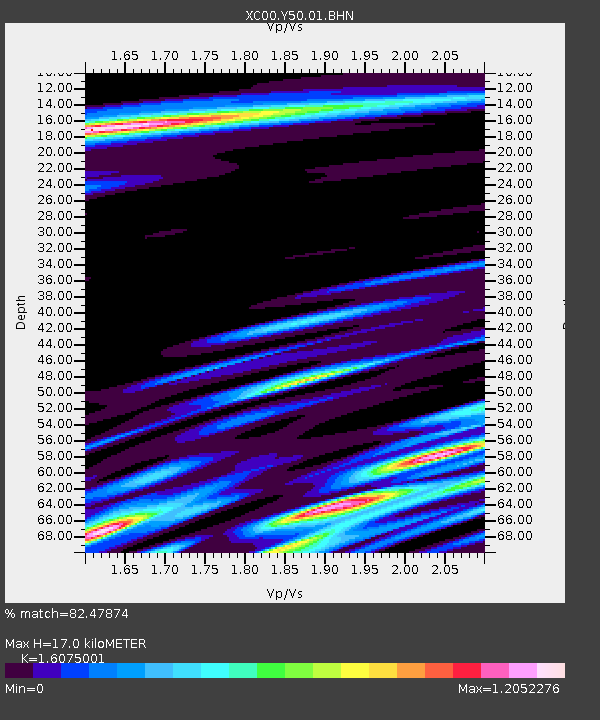
Y50 Y50 - Earthquake Result Viewer
| ||||||||||||||||||
| ||||||||||||||||||
| ||||||||||||||||||
|
Signal To Noise
| Channel | StoN | STA | LTA |
| XC:Y50:01:BHN:20000701T07:13:32.587996Z | 1.4053577 | 9.0753055E-8 | 6.457648E-8 |
| XC:Y50:01:BHE:20000701T07:13:32.587996Z | 0.6301816 | 8.9620414E-8 | 1.4221364E-7 |
| XC:Y50:01:BHZ:20000701T07:13:32.587996Z | 0.887968 | 1.4435892E-7 | 1.625722E-7 |
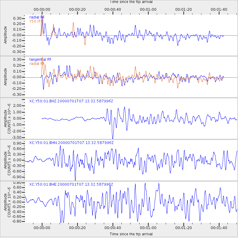
| Arrivals | |
| Ps | 1.7 SECOND |
| PpPs | 6.9 SECOND |
| PsPs/PpSs | 8.6 SECOND |

