
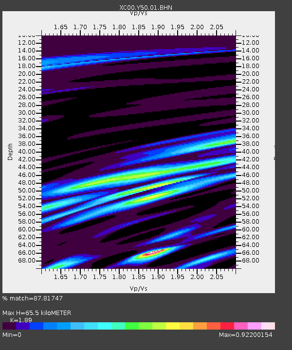
Y50 Y50 - Earthquake Result Viewer
| ||||||||||||||||||
| ||||||||||||||||||
| ||||||||||||||||||
|
Signal To Noise
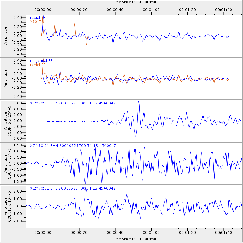
| Channel | StoN | STA | LTA |
| XC:Y50:01:BHN:20010525T00:51:13.454004Z | 0.76203644 | 1.313765E-7 | 1.7240184E-7 |
| XC:Y50:01:BHE:20010525T00:51:13.454004Z | 1.1470951 | 2.1930013E-7 | 1.9117869E-7 |
| XC:Y50:01:BHZ:20010525T00:51:13.454004Z | 1.8082732 | 1.971719E-7 | 1.0903878E-7 |
| Arrivals | |
| Ps | 9.7 SECOND |
| PpPs | 29 SECOND |
| PsPs/PpSs | 39 SECOND |

