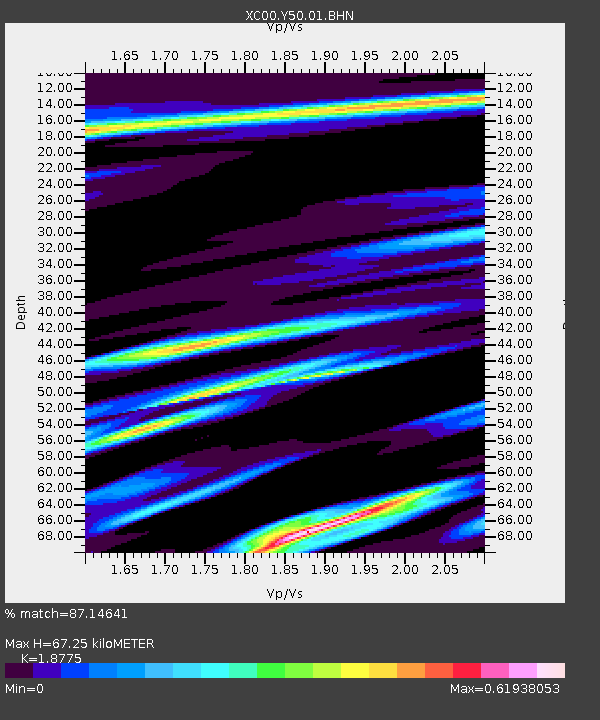
Y50 Y50 - Earthquake Result Viewer
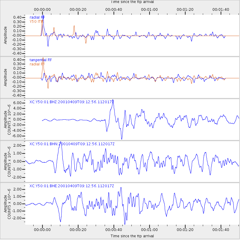
Earthquake location: Off Coast Of Central Chile
Earthquake latitude/longitude: -32.7/-73.1
Earthquake time(UTC): 2001/04/09 (099) 09:00:57 GMT
Earthquake Depth: 11 km
Earthquake Magnitude: 6.1 MB, 6.3 MS, 6.7 MW, 6.3 ME
Earthquake Catalog/Contributor: WHDF/NEIC
Network: XC Yellowstone Intermountain Seismic Array
Station: Y50 Y50
Lat/Lon: 45.15 N/108.97 W
Elevation: 1197 m
Distance: 84.0 deg
Az: 335.371 deg
Baz: 150.214 deg
Ray Param: 0.045769893
Estimated Moho Depth: 67.25 km
Estimated Crust Vp/Vs: 1.88
Assumed Crust Vp: 6.242 km/s
Estimated Crust Vs: 3.325 km/s
Estimated Crust Poisson's Ratio: 0.30
Radial Match: 87.14641 %
Radial Bump: 400
Transverse Match: 80.30454 %
Transverse Bump: 400
SOD ConfigId: 16820
Insert Time: 2010-02-26 14:58:18.983 +0000
GWidth: 2.5
Max Bumps: 400
Tol: 0.001

Signal To Noise

ChannelStoNSTALTA
XC:Y50:01:BHN:20010409T09:12:56.112017Z0.472750461.0598059E-72.2417872E-7
XC:Y50:01:BHE:20010409T09:12:56.112017Z0.60372421.7661075E-72.925355E-7
XC:Y50:01:BHZ:20010409T09:12:56.112017Z1.5556362.697608E-71.7340867E-7
Arrivals
Ps9.7 SECOND
PpPs30 SECOND
PsPs/PpSs40 SECOND