Y33 Y33 - Earthquake Result Viewer
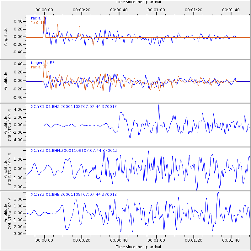
Earthquake location: Panama-Colombia Border Region
Earthquake latitude/longitude: 7.0/-77.8
Earthquake time(UTC): 2000/11/08 (313) 06:59:58 GMT
Earthquake Depth: 17 km
Earthquake Magnitude: 6.0 MB, 6.4 MS, 6.5 MW, 6.2 ML
Earthquake Catalog/Contributor: WHDF/NEIC
Network: XC Yellowstone Intermountain Seismic Array
Station: Y33 Y33
Lat/Lon: 43.23 N/108.98 W
Elevation: 1756 m
Distance: 45.3 deg
Az: 327.839 deg
Baz: 133.708 deg
Ray Param: 0.071381986
Estimated Moho Depth: 20.25 km
Estimated Crust Vp/Vs: 1.72
Assumed Crust Vp: 6.161 km/s
Estimated Crust Vs: 3.592 km/s
Estimated Crust Poisson's Ratio: 0.24
Radial Match: 87.6636 %
Radial Bump: 400
Transverse Match: 70.77437 %
Transverse Bump: 400
SOD ConfigId: 16820
Insert Time: 2010-02-26 14:58:24.289 +0000
GWidth: 2.5
Max Bumps: 400
Tol: 0.001

Signal To Noise

ChannelStoNSTALTA
XC:Y33:01:BHN:20001108T07:07:44.37001Z0.600808443.0125025E-75.014082E-7
XC:Y33:01:BHE:20001108T07:07:44.37001Z0.373919431.0610442E-72.837628E-7
XC:Y33:01:BHZ:20001108T07:07:44.37001Z1.52638463.2018414E-72.0976636E-7
Arrivals
Ps2.5 SECOND
PpPs8.4 SECOND
PsPs/PpSs11 SECOND