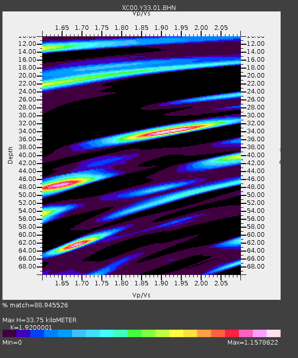
Y33 Y33 - Earthquake Result Viewer
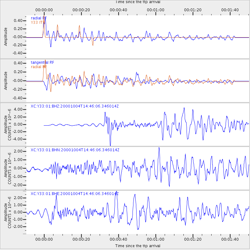
Earthquake location: Windward Islands
Earthquake latitude/longitude: 11.1/-62.6
Earthquake time(UTC): 2000/10/04 (278) 14:37:44 GMT
Earthquake Depth: 110 km
Earthquake Magnitude: 5.6 MB, 5.4 MS, 6.1 MW, 5.9 MD
Earthquake Catalog/Contributor: WHDF/NEIC
Network: XC Yellowstone Intermountain Seismic Array
Station: Y33 Y33
Lat/Lon: 43.23 N/108.98 W
Elevation: 1756 m
Distance: 51.3 deg
Az: 317.275 deg
Baz: 114.345 deg
Ray Param: 0.06714759
Estimated Moho Depth: 33.75 km
Estimated Crust Vp/Vs: 1.92
Assumed Crust Vp: 6.161 km/s
Estimated Crust Vs: 3.209 km/s
Estimated Crust Poisson's Ratio: 0.31
Radial Match: 88.945526 %
Radial Bump: 400
Transverse Match: 88.24439 %
Transverse Bump: 400
SOD ConfigId: 16820
Insert Time: 2010-02-26 14:58:25.291 +0000
GWidth: 2.5
Max Bumps: 400
Tol: 0.001

Signal To Noise

ChannelStoNSTALTA
XC:Y33:01:BHN:20001004T14:46:06.346014Z1.291272.1251437E-71.645778E-7
XC:Y33:01:BHE:20001004T14:46:06.346014Z3.12334788.005373E-72.5630746E-7
XC:Y33:01:BHZ:20001004T14:46:06.346014Z9.2059671.2792927E-61.3896343E-7
Arrivals
Ps5.3 SECOND
PpPs15 SECOND
PsPs/PpSs21 SECOND