
Y33 Y33 - Earthquake Result Viewer
| ||||||||||||||||||
| ||||||||||||||||||
| ||||||||||||||||||
|
Signal To Noise
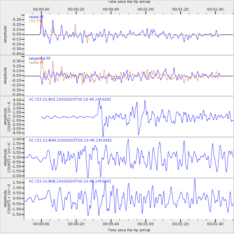
| Channel | StoN | STA | LTA |
| XC:Y33:01:BHN:20000926T06:29:48.245999Z | 1.3526902 | 4.92116E-7 | 3.6380536E-7 |
| XC:Y33:01:BHE:20000926T06:29:48.245999Z | 1.6323277 | 3.7945915E-7 | 2.3246507E-7 |
| XC:Y33:01:BHZ:20000926T06:29:48.245999Z | 9.724904 | 1.7465768E-6 | 1.7959836E-7 |
| Arrivals | |
| Ps | 2.5 SECOND |
| PpPs | 6.9 SECOND |
| PsPs/PpSs | 9.4 SECOND |

