
Y33 Y33 - Earthquake Result Viewer
| ||||||||||||||||||
| ||||||||||||||||||
| ||||||||||||||||||
|
Signal To Noise
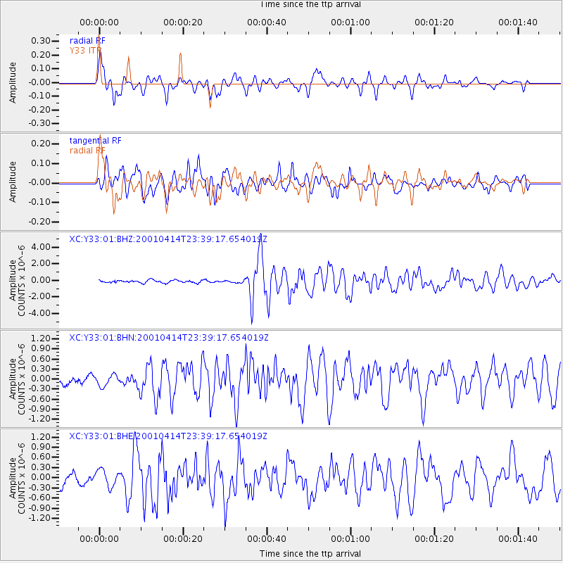
| Channel | StoN | STA | LTA |
| XC:Y33:01:BHN:20010414T23:39:17.654019Z | 0.8499919 | 1.814426E-7 | 2.1346392E-7 |
| XC:Y33:01:BHE:20010414T23:39:17.654019Z | 1.3647978 | 2.4532227E-7 | 1.797499E-7 |
| XC:Y33:01:BHZ:20010414T23:39:17.654019Z | 0.84897256 | 1.3602883E-7 | 1.6022759E-7 |
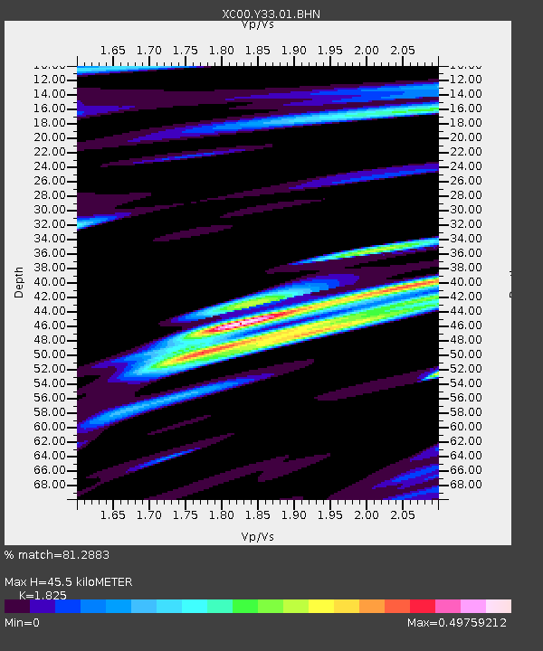
| Arrivals | |
| Ps | 6.2 SECOND |
| PpPs | 20 SECOND |
| PsPs/PpSs | 27 SECOND |

