
Y33 Y33 - Earthquake Result Viewer
| ||||||||||||||||||
| ||||||||||||||||||
| ||||||||||||||||||
|
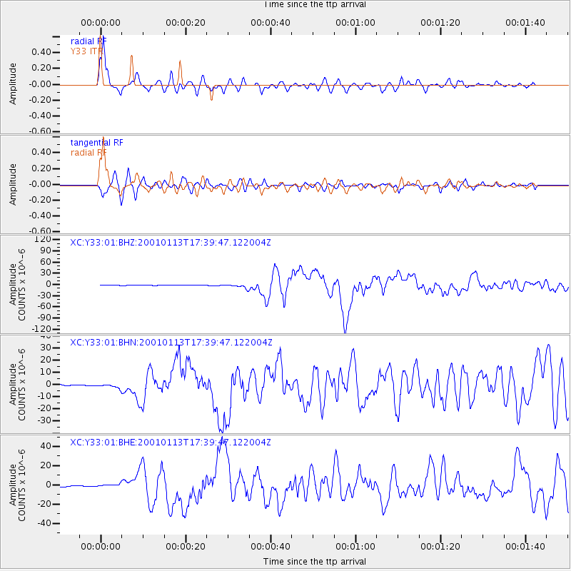
Signal To Noise
| Channel | StoN | STA | LTA |
| XC:Y33:01:BHN:20010113T17:39:47.122004Z | 3.1986802 | 1.7282779E-6 | 5.4030966E-7 |
| XC:Y33:01:BHE:20010113T17:39:47.122004Z | 2.247482 | 1.5128013E-6 | 6.731094E-7 |
| XC:Y33:01:BHZ:20010113T17:39:47.122004Z | 15.143067 | 5.4879556E-6 | 3.6240715E-7 |
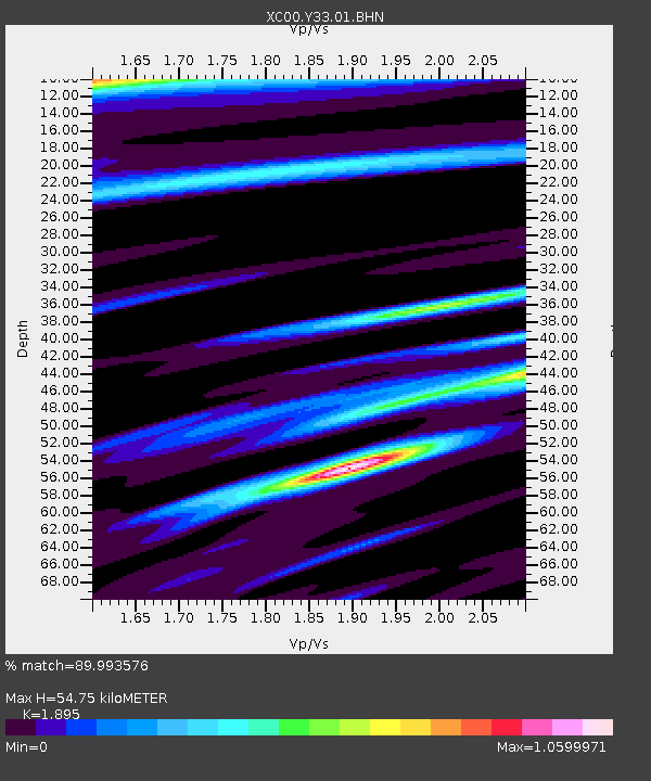
| Arrivals | |
| Ps | 8.5 SECOND |
| PpPs | 24 SECOND |
| PsPs/PpSs | 33 SECOND |

