
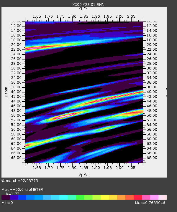
Y33 Y33 - Earthquake Result Viewer
| ||||||||||||||||||
| ||||||||||||||||||
| ||||||||||||||||||
|
Signal To Noise
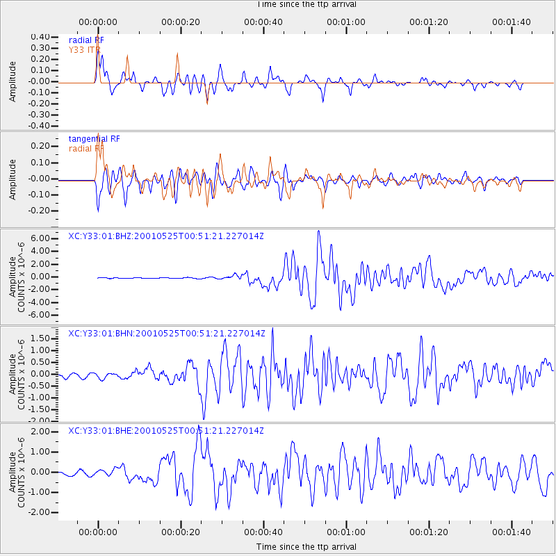
| Channel | StoN | STA | LTA |
| XC:Y33:01:BHN:20010525T00:51:21.227014Z | 1.8167213 | 1.1249714E-7 | 6.192317E-8 |
| XC:Y33:01:BHE:20010525T00:51:21.227014Z | 1.2159305 | 1.5019182E-7 | 1.2352007E-7 |
| XC:Y33:01:BHZ:20010525T00:51:21.227014Z | 5.3187175 | 3.102666E-7 | 5.833485E-8 |
| Arrivals | |
| Ps | 6.5 SECOND |
| PpPs | 22 SECOND |
| PsPs/PpSs | 28 SECOND |

