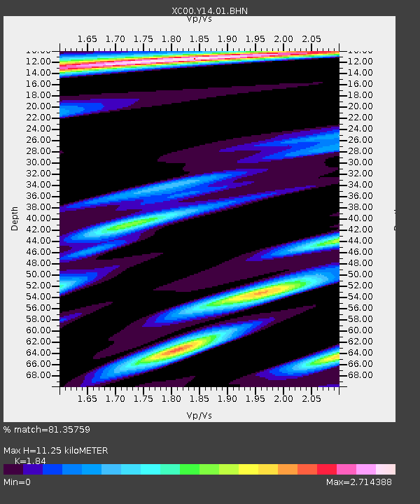
Y14 Y14 - Earthquake Result Viewer
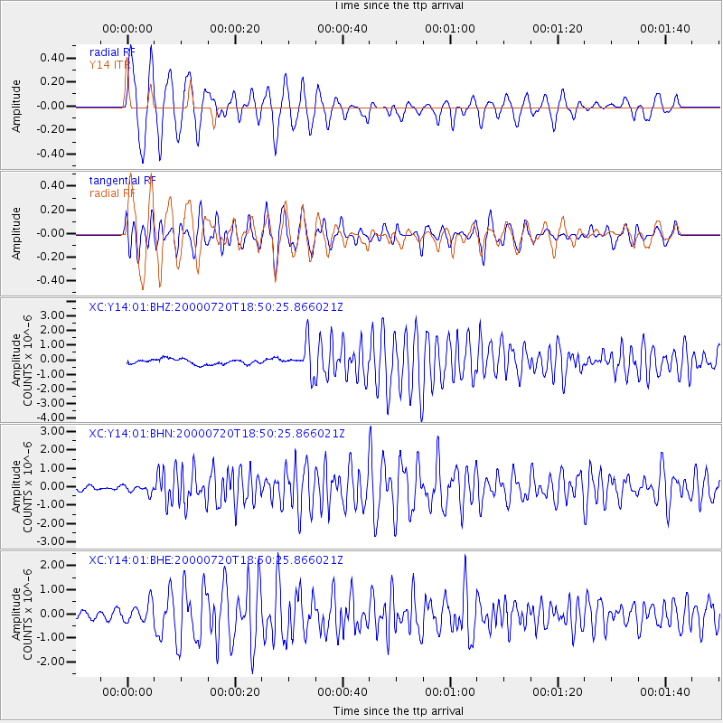
Earthquake location: Near East Coast Of Honshu, Japan
Earthquake latitude/longitude: 36.5/141.0
Earthquake time(UTC): 2000/07/20 (202) 18:39:18 GMT
Earthquake Depth: 47 km
Earthquake Magnitude: 6.1 MB, 5.4 MS, 6.1 ME, 6.0 MW
Earthquake Catalog/Contributor: WHDF/NEIC
Network: XC Yellowstone Intermountain Seismic Array
Station: Y14 Y14
Lat/Lon: 44.99 N/112.46 W
Elevation: 1863 m
Distance: 75.3 deg
Az: 44.695 deg
Baz: 307.01 deg
Ray Param: 0.051704675
Estimated Moho Depth: 11.25 km
Estimated Crust Vp/Vs: 1.84
Assumed Crust Vp: 6.577 km/s
Estimated Crust Vs: 3.574 km/s
Estimated Crust Poisson's Ratio: 0.29
Radial Match: 81.35759 %
Radial Bump: 400
Transverse Match: 71.13937 %
Transverse Bump: 400
SOD ConfigId: 16820
Insert Time: 2010-02-26 14:58:33.874 +0000
GWidth: 2.5
Max Bumps: 400
Tol: 0.001

Signal To Noise

ChannelStoNSTALTA
XC:Y14:01:BHN:20000720T18:50:25.866021Z1.34277732.1655671E-71.6127524E-7
XC:Y14:01:BHE:20000720T18:50:25.866021Z2.26538324.0196824E-71.774394E-7
XC:Y14:01:BHZ:20000720T18:50:25.866021Z5.68113331.0049359E-61.7689005E-7
Arrivals
Ps1.5 SECOND
PpPs4.7 SECOND
PsPs/PpSs6.2 SECOND