Y14 Y14 - Earthquake Result Viewer
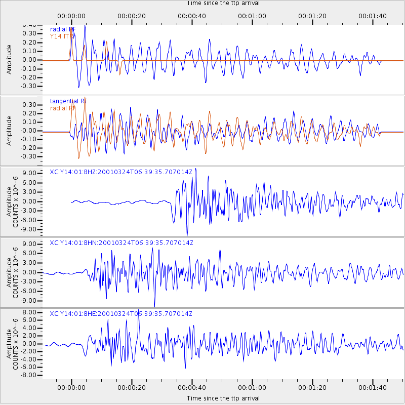
Earthquake location: Western Honshu, Japan
Earthquake latitude/longitude: 34.1/132.5
Earthquake time(UTC): 2001/03/24 (083) 06:27:53 GMT
Earthquake Depth: 50 km
Earthquake Magnitude: 6.4 MB, 6.5 MS, 6.8 MW, 6.4 ME
Earthquake Catalog/Contributor: WHDF/NEIC
Network: XC Yellowstone Intermountain Seismic Array
Station: Y14 Y14
Lat/Lon: 44.99 N/112.46 W
Elevation: 1863 m
Distance: 81.7 deg
Az: 40.527 deg
Baz: 310.533 deg
Ray Param: 0.04729924
Estimated Moho Depth: 11.75 km
Estimated Crust Vp/Vs: 1.71
Assumed Crust Vp: 6.577 km/s
Estimated Crust Vs: 3.857 km/s
Estimated Crust Poisson's Ratio: 0.24
Radial Match: 83.16978 %
Radial Bump: 400
Transverse Match: 73.994774 %
Transverse Bump: 400
SOD ConfigId: 4714
Insert Time: 2010-02-26 14:58:41.939 +0000
GWidth: 2.5
Max Bumps: 400
Tol: 0.001

Signal To Noise

ChannelStoNSTALTA
XC:Y14:01:BHN:20010324T06:39:35.707014Z1.28255944.360876E-73.4001354E-7
XC:Y14:01:BHE:20010324T06:39:35.707014Z4.1554839.922085E-72.3877092E-7
XC:Y14:01:BHZ:20010324T06:39:35.707014Z6.53480962.4461986E-63.7433355E-7
Arrivals
Ps1.3 SECOND
PpPs4.7 SECOND
PsPs/PpSs6.0 SECOND