Y32 Y32 - Earthquake Result Viewer
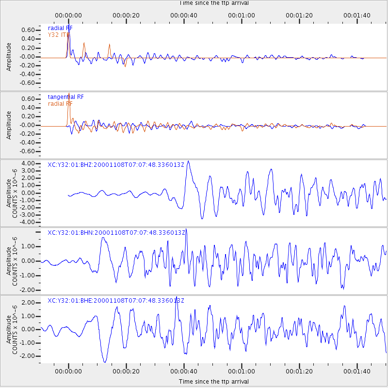
Earthquake location: Panama-Colombia Border Region
Earthquake latitude/longitude: 7.0/-77.8
Earthquake time(UTC): 2000/11/08 (313) 06:59:58 GMT
Earthquake Depth: 17 km
Earthquake Magnitude: 6.0 MB, 6.4 MS, 6.5 MW, 6.2 ML
Earthquake Catalog/Contributor: WHDF/NEIC
Network: XC Yellowstone Intermountain Seismic Array
Station: Y32 Y32
Lat/Lon: 43.58 N/109.45 W
Elevation: 2138 m
Distance: 45.7 deg
Az: 327.86 deg
Baz: 133.397 deg
Ray Param: 0.07105759
Estimated Moho Depth: 15.75 km
Estimated Crust Vp/Vs: 1.62
Assumed Crust Vp: 6.161 km/s
Estimated Crust Vs: 3.791 km/s
Estimated Crust Poisson's Ratio: 0.20
Radial Match: 93.44856 %
Radial Bump: 379
Transverse Match: 71.06611 %
Transverse Bump: 400
SOD ConfigId: 3744
Insert Time: 2010-02-26 14:58:52.106 +0000
GWidth: 2.5
Max Bumps: 400
Tol: 0.001

Signal To Noise

ChannelStoNSTALTA
XC:Y32:01:BHN:20001108T07:07:48.336013Z0.53118561.4936816E-72.8119766E-7
XC:Y32:01:BHE:20001108T07:07:48.336013Z1.38956262.6422316E-71.9014844E-7
XC:Y32:01:BHZ:20001108T07:07:48.336013Z1.42940373.2886447E-72.3007111E-7
Arrivals
Ps1.7 SECOND
PpPs6.3 SECOND
PsPs/PpSs8.0 SECOND