Y13 Y13 - Earthquake Result Viewer
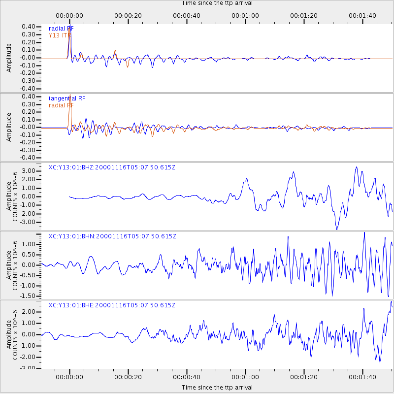
Earthquake location: New Ireland Region, P.N.G.
Earthquake latitude/longitude: -4.0/152.2
Earthquake time(UTC): 2000/11/16 (321) 04:54:56 GMT
Earthquake Depth: 33 km
Earthquake Magnitude: 6.0 MB, 8.2 MS, 8.0 MW, 8.0 ME
Earthquake Catalog/Contributor: WHDF/NEIC
Network: XC Yellowstone Intermountain Seismic Array
Station: Y13 Y13
Lat/Lon: 45.27 N/112.82 W
Elevation: 1808 m
Distance: 96.3 deg
Az: 45.054 deg
Baz: 270.751 deg
Ray Param: 0.040529538
Estimated Moho Depth: 40.0 km
Estimated Crust Vp/Vs: 1.60
Assumed Crust Vp: 6.577 km/s
Estimated Crust Vs: 4.111 km/s
Estimated Crust Poisson's Ratio: 0.18
Radial Match: 88.53076 %
Radial Bump: 400
Transverse Match: 66.59398 %
Transverse Bump: 400
SOD ConfigId: 3744
Insert Time: 2010-02-26 14:59:09.987 +0000
GWidth: 2.5
Max Bumps: 400
Tol: 0.001

Signal To Noise

ChannelStoNSTALTA
XC:Y13:01:BHN:20001116T05:07:50.615Z1.0659631.7190085E-71.6126343E-7
XC:Y13:01:BHE:20001116T05:07:50.615Z0.66329571.510737E-72.2776223E-7
XC:Y13:01:BHZ:20001116T05:07:50.615Z1.67367592.0568962E-71.2289692E-7
Arrivals
Ps3.7 SECOND
PpPs15 SECOND
PsPs/PpSs19 SECOND