
Y13 Y13 - Earthquake Result Viewer
| ||||||||||||||||||
| ||||||||||||||||||
| ||||||||||||||||||
|
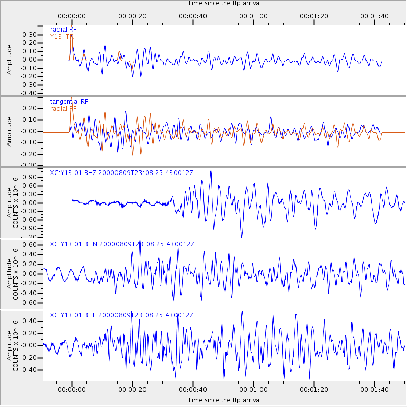
Signal To Noise
| Channel | StoN | STA | LTA |
| XC:Y13:01:BHN:20000809T23:08:25.430012Z | 1.4833332 | 9.6595556E-8 | 6.51206E-8 |
| XC:Y13:01:BHE:20000809T23:08:25.430012Z | 1.3649677 | 9.4327106E-8 | 6.9105745E-8 |
| XC:Y13:01:BHZ:20000809T23:08:25.430012Z | 2.3995707 | 1.3428834E-7 | 5.5963486E-8 |
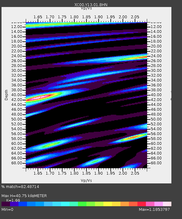
| Arrivals | |
| Ps | 4.2 SECOND |
| PpPs | 16 SECOND |
| PsPs/PpSs | 20 SECOND |

