
Y13 Y13 - Earthquake Result Viewer
| ||||||||||||||||||
| ||||||||||||||||||
| ||||||||||||||||||
|
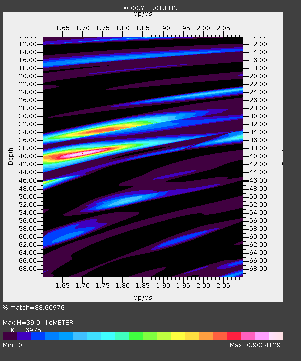
Signal To Noise
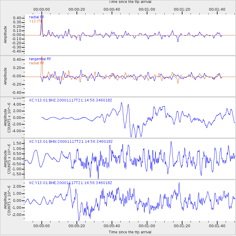
| Channel | StoN | STA | LTA |
| XC:Y13:01:BHN:20001117T21:14:56.346018Z | 2.3331 | 5.2987133E-7 | 2.2711042E-7 |
| XC:Y13:01:BHE:20001117T21:14:56.346018Z | 2.3540044 | 3.7617522E-7 | 1.5980227E-7 |
| XC:Y13:01:BHZ:20001117T21:14:56.346018Z | 2.6207676 | 5.962406E-7 | 2.2750609E-7 |
| Arrivals | |
| Ps | 4.2 SECOND |
| PpPs | 16 SECOND |
| PsPs/PpSs | 20 SECOND |

