
Y13 Y13 - Earthquake Result Viewer
| ||||||||||||||||||
| ||||||||||||||||||
| ||||||||||||||||||
|
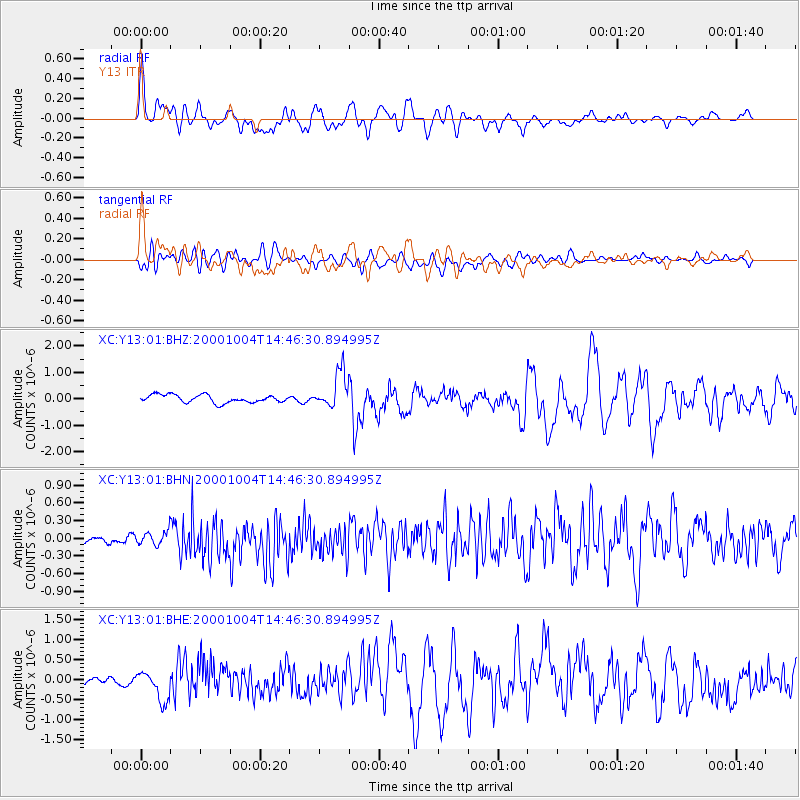
Signal To Noise
| Channel | StoN | STA | LTA |
| XC:Y13:01:BHN:20001004T14:46:30.894995Z | 0.90189683 | 1.3276355E-7 | 1.472048E-7 |
| XC:Y13:01:BHE:20001004T14:46:30.894995Z | 2.5203736 | 3.5152664E-7 | 1.3947401E-7 |
| XC:Y13:01:BHZ:20001004T14:46:30.894995Z | 4.5926313 | 6.712742E-7 | 1.4616332E-7 |
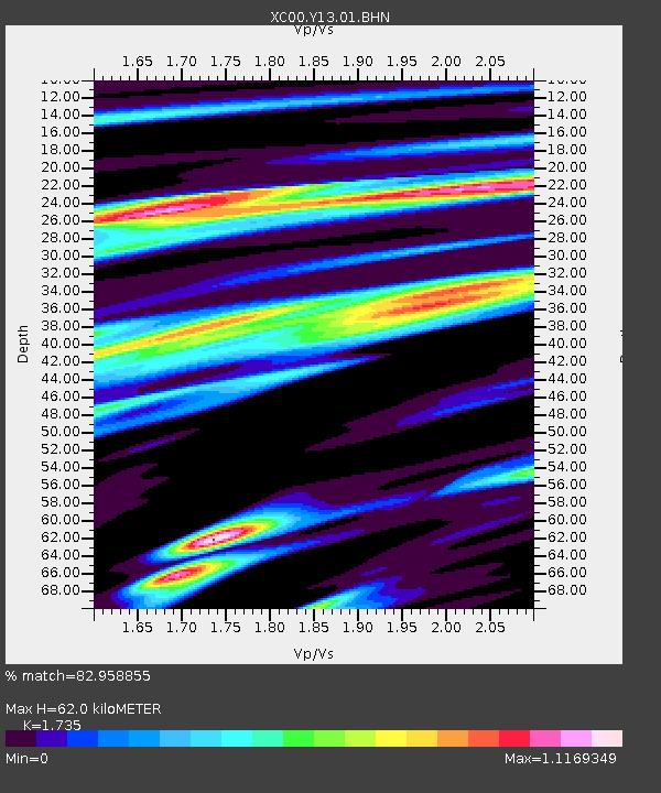
| Arrivals | |
| Ps | 7.3 SECOND |
| PpPs | 24 SECOND |
| PsPs/PpSs | 32 SECOND |

