
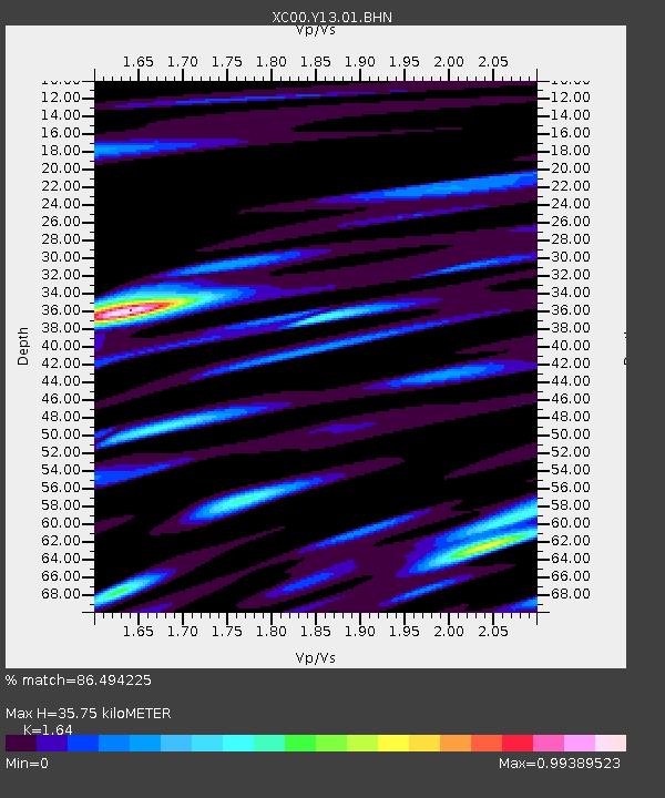
Y13 Y13 - Earthquake Result Viewer
| ||||||||||||||||||
| ||||||||||||||||||
| ||||||||||||||||||
|
Signal To Noise
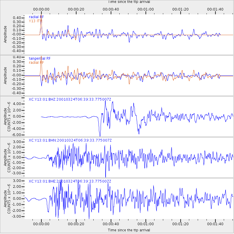
| Channel | StoN | STA | LTA |
| XC:Y13:01:BHN:20010324T06:39:33.775007Z | 0.8103483 | 2.3556777E-7 | 2.9069943E-7 |
| XC:Y13:01:BHE:20010324T06:39:33.775007Z | 3.0404317 | 8.233699E-7 | 2.7080688E-7 |
| XC:Y13:01:BHZ:20010324T06:39:33.775007Z | 31.90453 | 2.3033779E-6 | 7.219595E-8 |
| Arrivals | |
| Ps | 3.6 SECOND |
| PpPs | 14 SECOND |
| PsPs/PpSs | 18 SECOND |

