
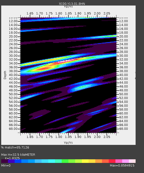
Y13 Y13 - Earthquake Result Viewer
| ||||||||||||||||||
| ||||||||||||||||||
| ||||||||||||||||||
|
Signal To Noise
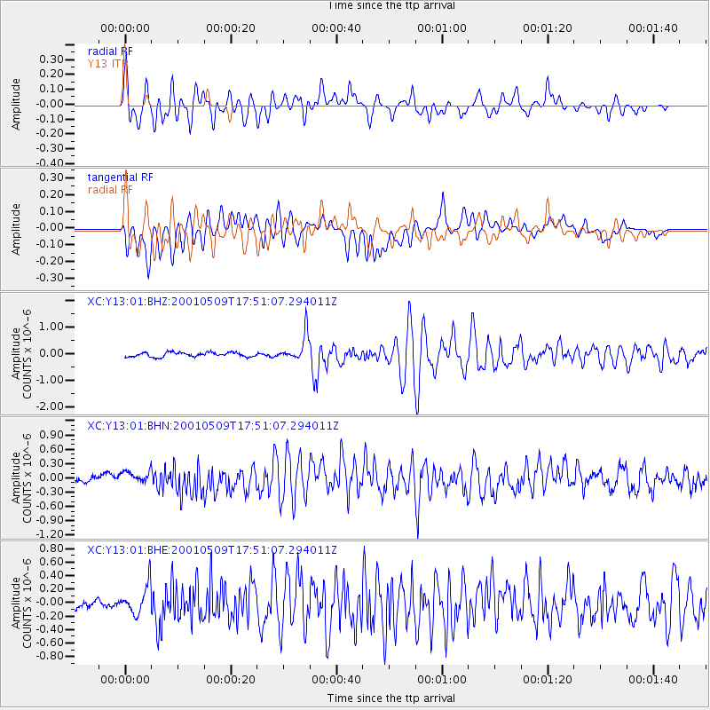
| Channel | StoN | STA | LTA |
| XC:Y13:01:BHN:20010509T17:51:07.294011Z | 1.8683565 | 1.3170306E-7 | 7.04914E-8 |
| XC:Y13:01:BHE:20010509T17:51:07.294011Z | 3.020579 | 2.1004331E-7 | 6.9537435E-8 |
| XC:Y13:01:BHZ:20010509T17:51:07.294011Z | 5.9330845 | 4.8931565E-7 | 8.247239E-8 |
| Arrivals | |
| Ps | 4.2 SECOND |
| PpPs | 14 SECOND |
| PsPs/PpSs | 18 SECOND |

