
Y39 Y39 - Earthquake Result Viewer
| ||||||||||||||||||
| ||||||||||||||||||
| ||||||||||||||||||
|
Signal To Noise
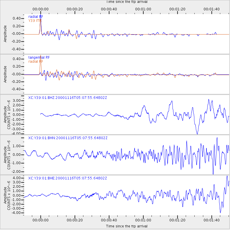
| Channel | StoN | STA | LTA |
| XC:Y39:01:BHN:20001116T05:07:55.64802Z | 0.8807155 | 1.8129703E-7 | 2.0585198E-7 |
| XC:Y39:01:BHE:20001116T05:07:55.64802Z | 0.42410934 | 1.6336914E-7 | 3.8520523E-7 |
| XC:Y39:01:BHZ:20001116T05:07:55.64802Z | 0.92804635 | 1.6618957E-7 | 1.7907463E-7 |
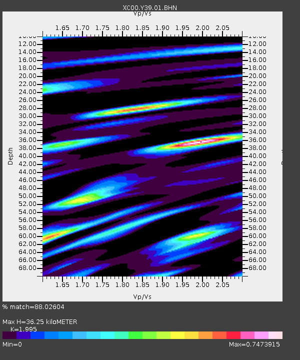
| Arrivals | |
| Ps | 5.8 SECOND |
| PpPs | 17 SECOND |
| PsPs/PpSs | 23 SECOND |

