
Y39 Y39 - Earthquake Result Viewer
| ||||||||||||||||||
| ||||||||||||||||||
| ||||||||||||||||||
|
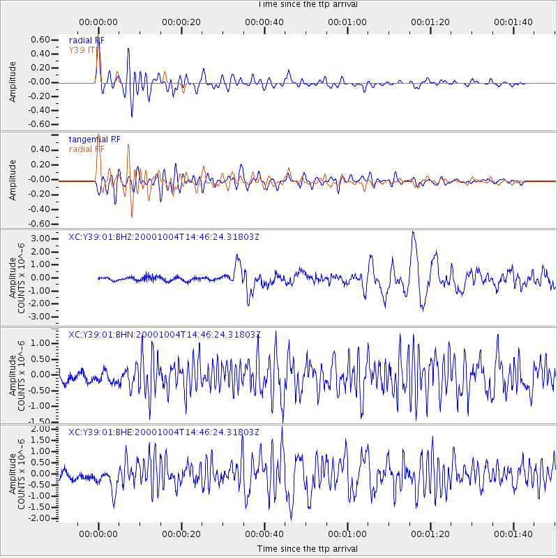
Signal To Noise
| Channel | StoN | STA | LTA |
| XC:Y39:01:BHN:20001004T14:46:24.31803Z | 1.135261 | 1.9676055E-7 | 1.7331745E-7 |
| XC:Y39:01:BHE:20001004T14:46:24.31803Z | 2.968341 | 5.571577E-7 | 1.8770001E-7 |
| XC:Y39:01:BHZ:20001004T14:46:24.31803Z | 5.1512284 | 7.789411E-7 | 1.5121465E-7 |
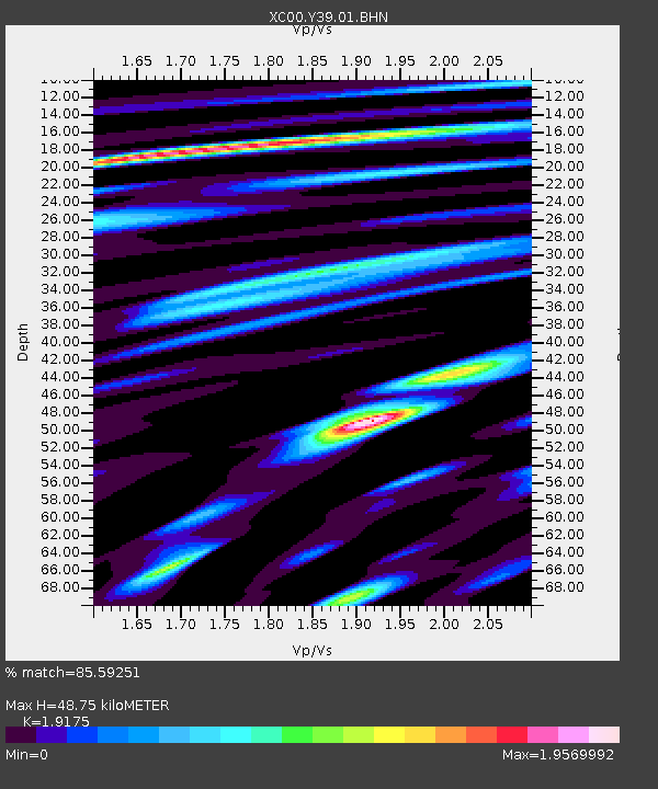
| Arrivals | |
| Ps | 7.4 SECOND |
| PpPs | 21 SECOND |
| PsPs/PpSs | 29 SECOND |

